Ring Road – Iceland
Road Trip through Iceland
A Journey Around the Island on the Iconic Ring Road
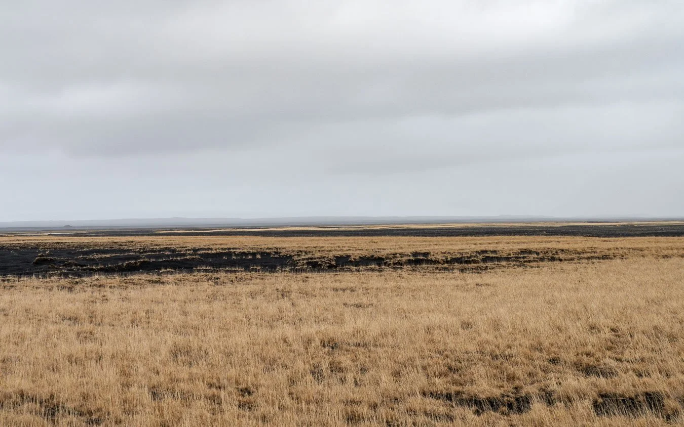
Iceland, situated at the meeting point of the Eurasian and North American tectonic plates and brushing the Arctic Circle, is famously known as the ‘Land of Fire and Ice’. This nickname reflects its extraordinary combination of volcanoes and glaciers, which together shape its dramatic and unique landscapes. The island’s volcanic origins are evident in its black sand beaches, lava fields, and sparse vegetation, lending much of the terrain an otherworldly, almost lunar appearance. Adding to this surreal charm are the numerous geothermal areas scattered across the country, bubbling with hot springs, fumaroles, and geysers. The dynamic interaction between Iceland’s glaciers and volcanic topography has also created an abundance of waterfalls, many of which cascade down rugged cliffs before reaching the coastline. These waterfalls are among Iceland's most iconic natural features, fed by glacial meltwater and frequent rainfall.
In contrast to Iceland’s interior highlands – remote, largely untouched, and accessible only during summer with thorough preparation – the coastal areas are much easier to explore year-round. In this blog post, we’ll focus on Iceland’s famous Ring Road (Route 1), a highway that circles the island and offers a comprehensive introduction to its breathtaking landscapes, from majestic waterfalls to volcanic beaches. For those seeking to experience Iceland’s highlights without venturing into the highlands, the Ring Road provides the ideal itinerary. Before we dive into the details of our journey, here’s a quick overview to help you navigate the post and skip directly to the sections that interest you the most.
Overview
Itinerary | Planning | Recommendations | Conclusion | Links | Map
Itinerary
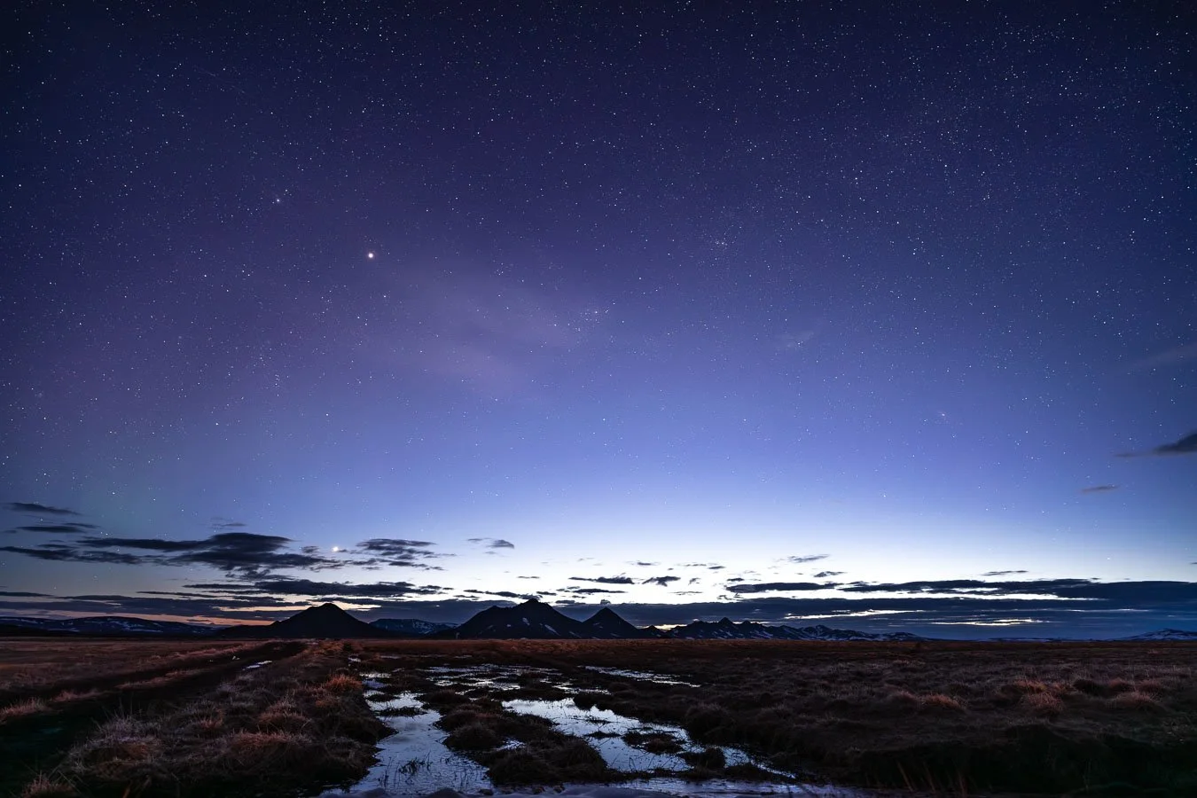
Our journey began with a flight into Keflavík International Airport. One of our considerations for going to Iceland in early spring was the (albeit small) chance of still spotting auroras. Imagine our surprise when, upon arrival, we were already greeted by a spectacular display of the northern lights! While stunning, watching it through the airplane windows didn’t allow to fully enjoy the show, for which reason we wanted to get another chance during our roughly two weeks in Iceland (but more on that below). After picking up our campervan, we headed to Reykjavík, where we spent the night at one of the few campsites open during the off-season before starting our Ring Road adventure.
Dramatic cliffs along the route to the Fagradalsfjall volcano eruption site in southwestern Iceland.
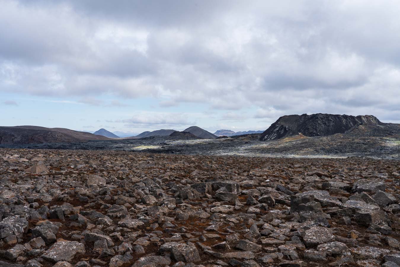
The next morning, we stocked up on groceries and made our way to our first point of interest – the Fagradalsfjall volcano eruption site and its impressive crater. There are three hiking trails of varying lengths starting from different parking areas (as of 2023). We opted for Route A, a 6–8 km round-trip hike (depending on where you park), which took us around 2 to 2.5 hours. The trail itself was well-maintained, though the strong winds typical of the area made some sections more challenging. Along the way, we enjoyed stunning views of the vast lava fields and barren landscapes stretching into the distance. Clear skies with some single clouds during our visit created dramatic lighting and shadows on the surrounding hills. Before attempting this hike, be sure to check Safetravel.is for up-to-date information on recent eruptions and potential restrictions.
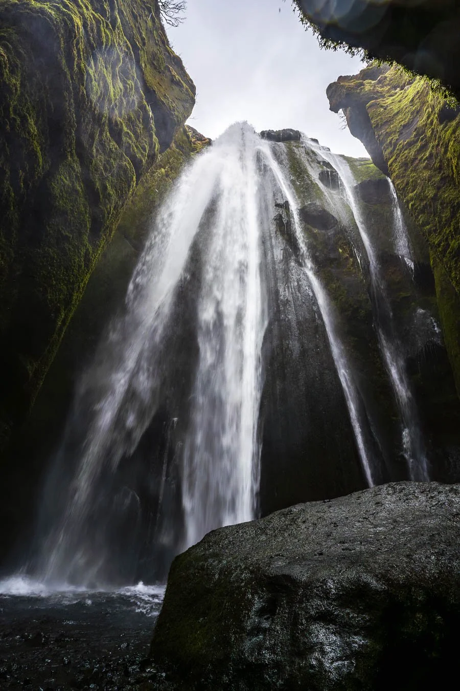
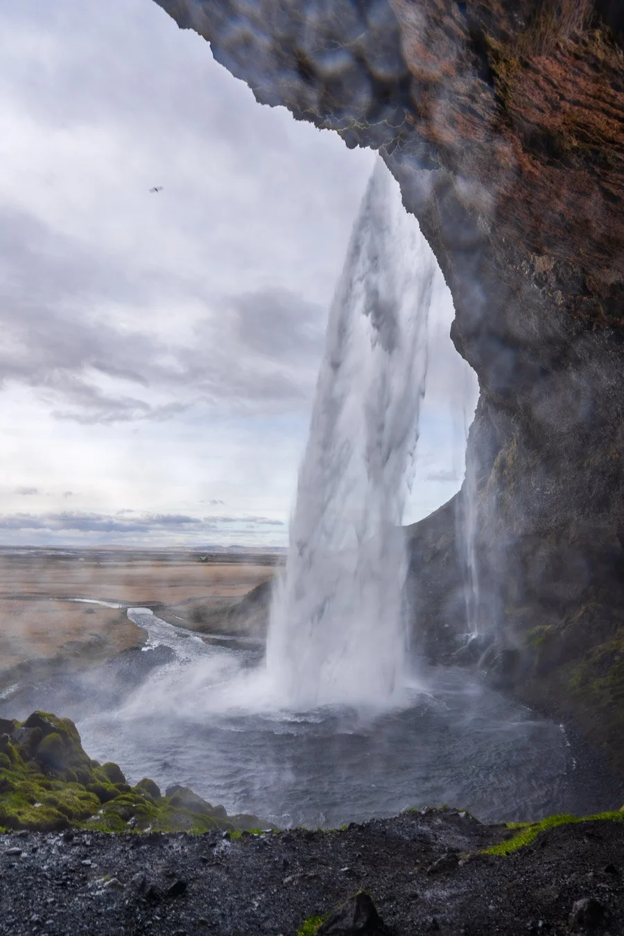
Our next stop that day was the iconic Seljalandsfoss and Gljúfrabúi waterfalls. We arrived at the parking lot in the late afternoon, just as the sun was beginning to set. Despite visiting in mid-April (technically still off-season) the area was quite busy. Seljalandsfoss is conveniently located right next to the car park, and a short trail allows you to walk behind the waterfall, offering a unique perspective. Be prepared to get soaked by the spray though!
Just a few hundred meters away is Gljúfrabúi, hidden behind a narrow gorge. To reach the waterfall, you must walk through a shallow stream, stepping carefully on the rocks – a very short but ‘adventurous’ trek. In our opinion, this waterfall was even more impressive due to its more secluded setting and the added thrill of navigating the stream. The slightly more challenging access also kept the crowds smaller, which made for a more peaceful experience.
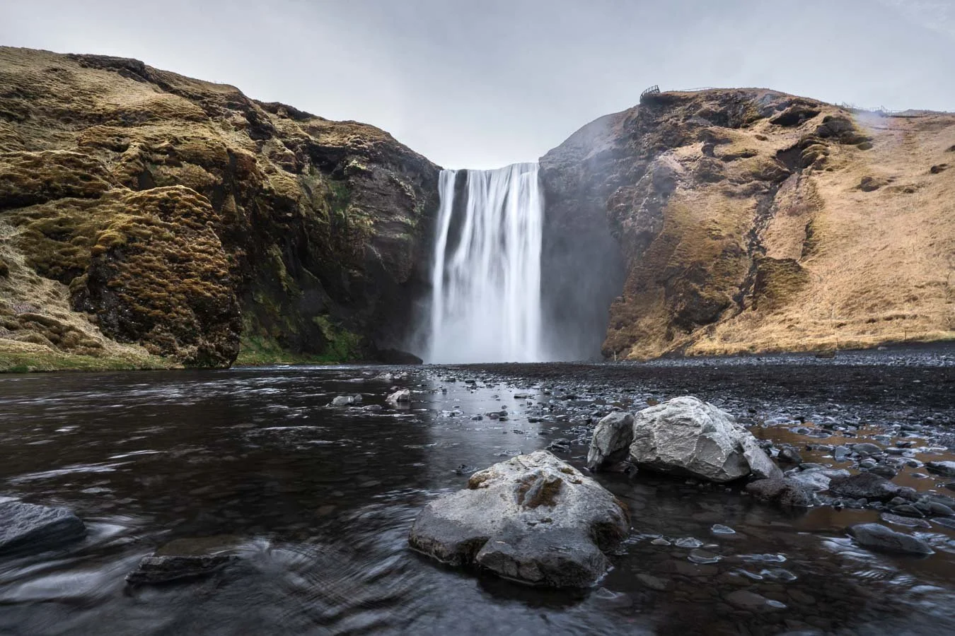
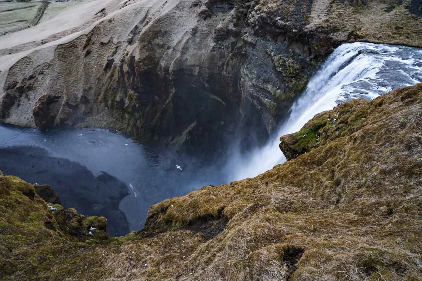
We ended the day at the Skógafoss waterfall, located right along the Ring Road. The large car park next to the waterfall also serves as a campground with basic facilities. Skógafoss is a powerful sight due to its immense height and width. It’s also the southern starting point for the famous Fimmvörðuháls (& Laugavegur Trail), which we hope to hike on a future trip!
The next morning, we intended to reach the Reynisfjara viewpoint for sunrise. However, strong winds delayed our journey, as gusts in Iceland can pose a serious risk to high-profile vehicles (like our campervan). Be mindful when driving on exposed roads and when opening car doors, as the wind can slam them open violently (more on that below). Although we missed the sunrise at the beach, we still caught a dramatic one on the way there.
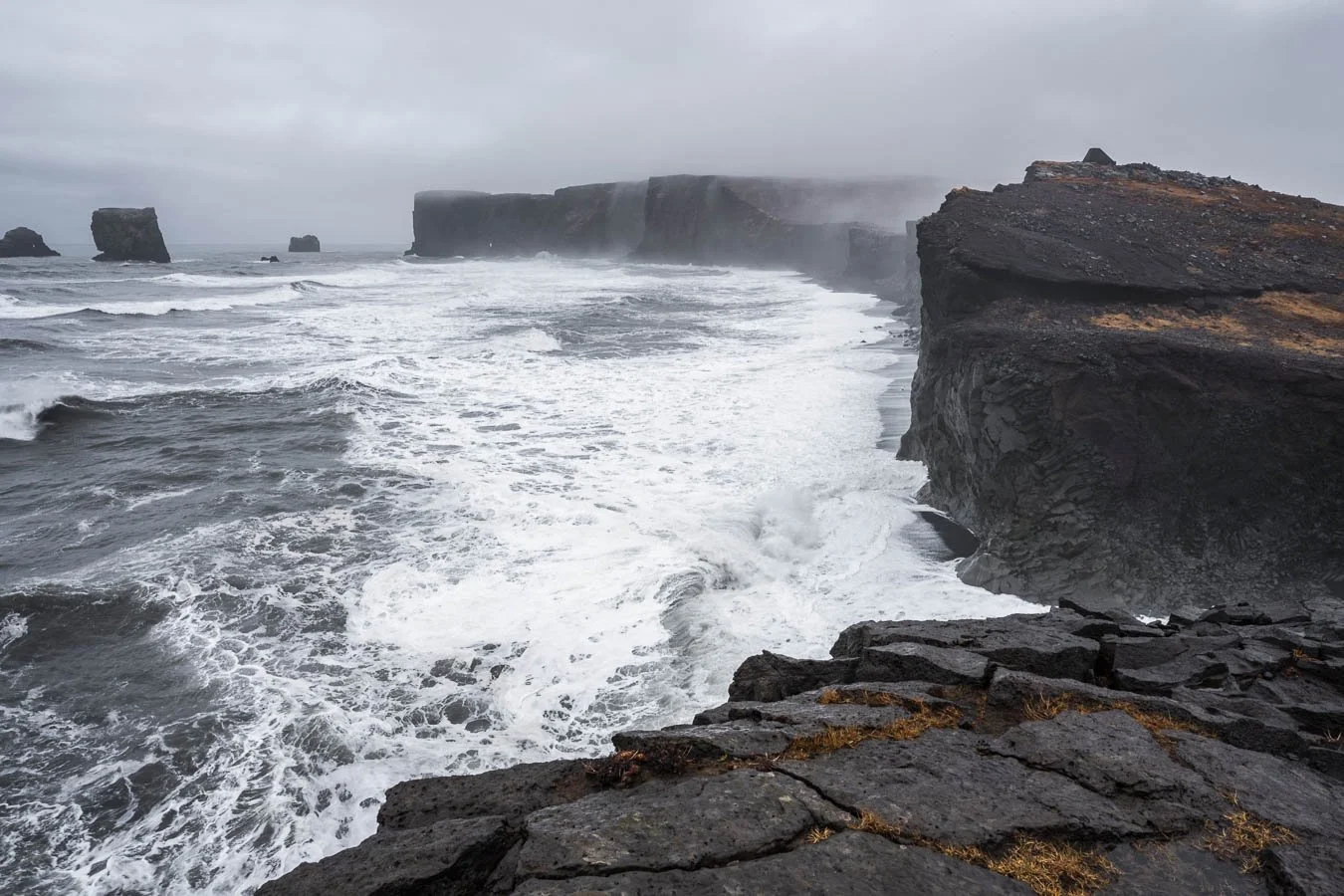
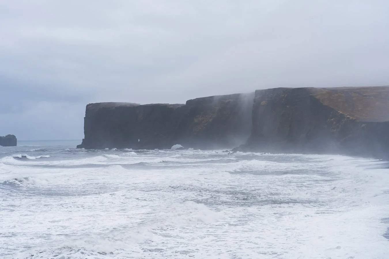
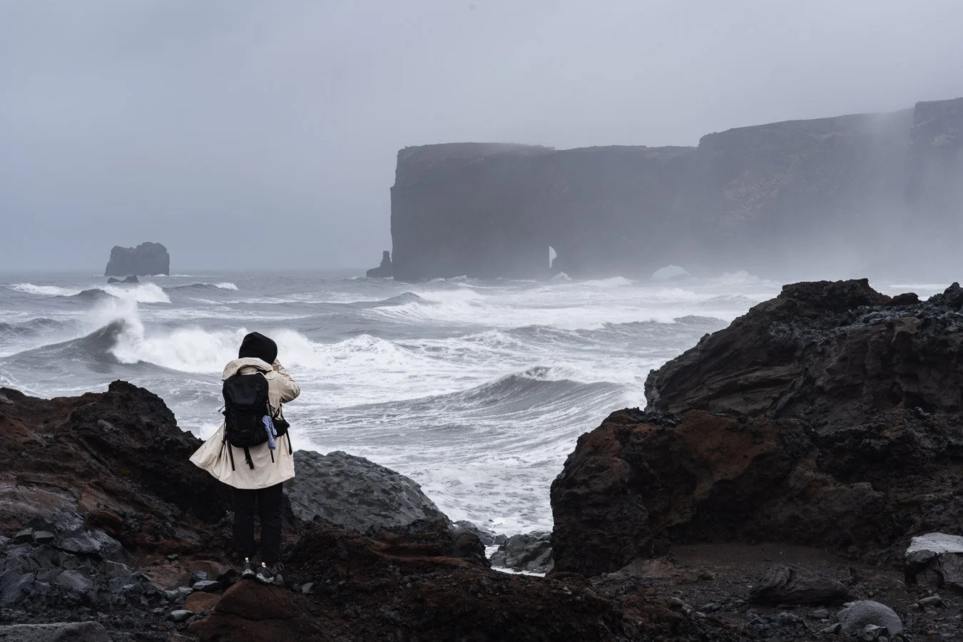
When we finally arrived, the stormy weather added an intense atmosphere to the already dramatic black sand beach. The dark gray clouds and strong winds perfectly complemented the rugged landscape. The viewpoint offers sweeping views of the towering basalt cliffs and the distant Reynisdrangar sea stacks. On the way, we also passed the famous DC-3 plane wreck. Reaching the site, however, requires a long walk of approximately 8 km round-trip (45–60 min), so be sure to allocate enough time if you want to snap some ‘Instagram-worthy’ shots at the wreck.
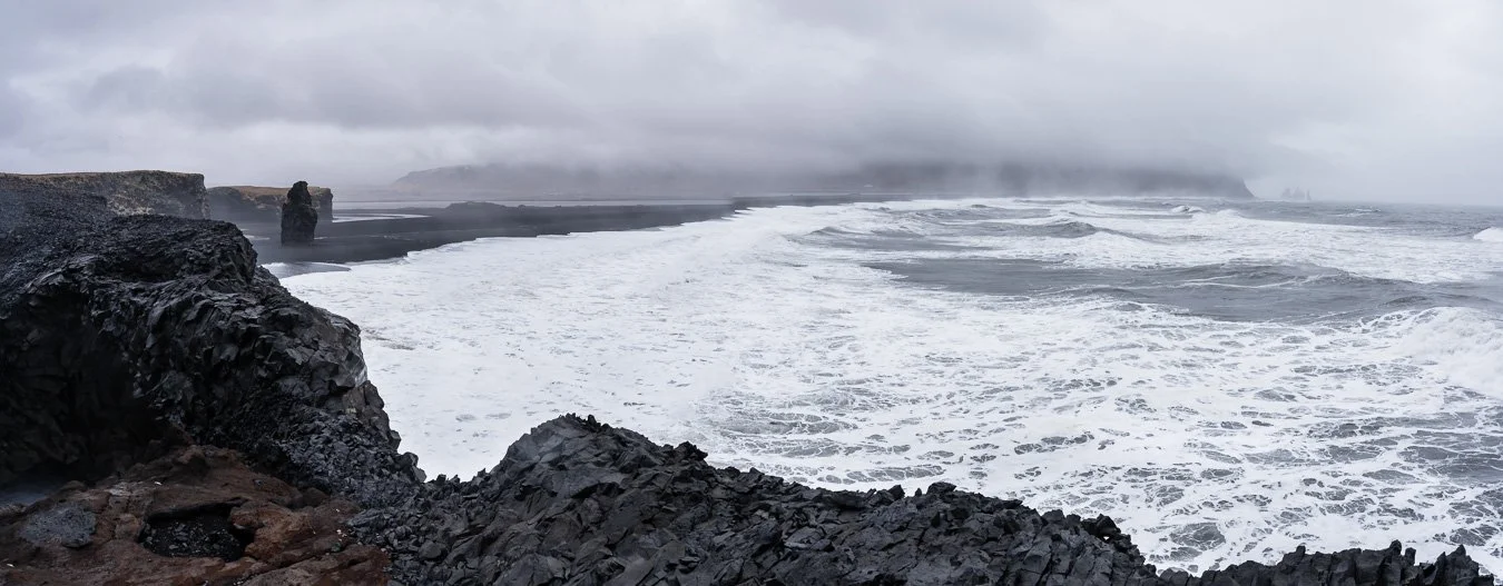
Panoramic view from Reynisfjara Viewpoint with Reynisdrangar rock formations in the distance.
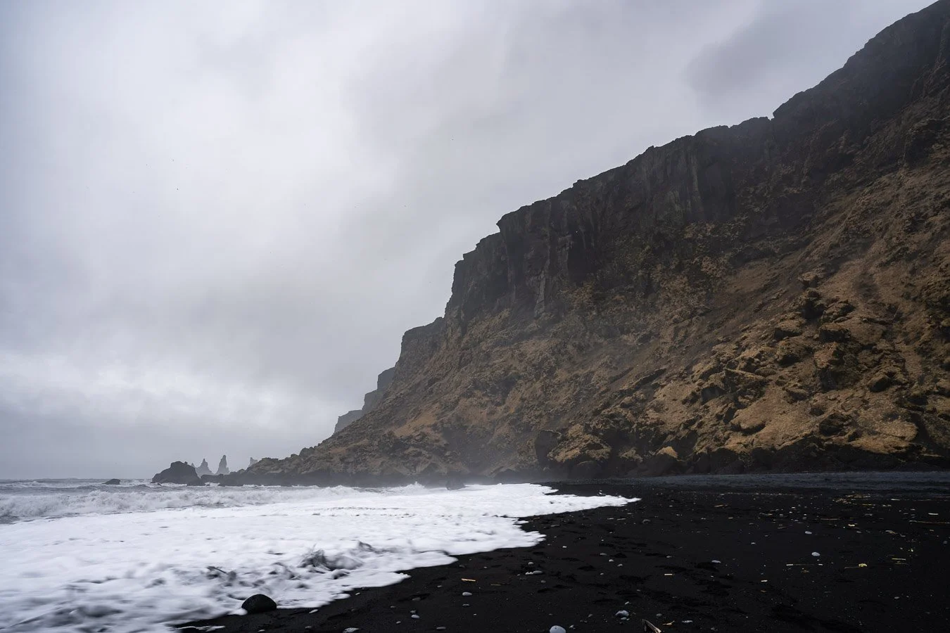
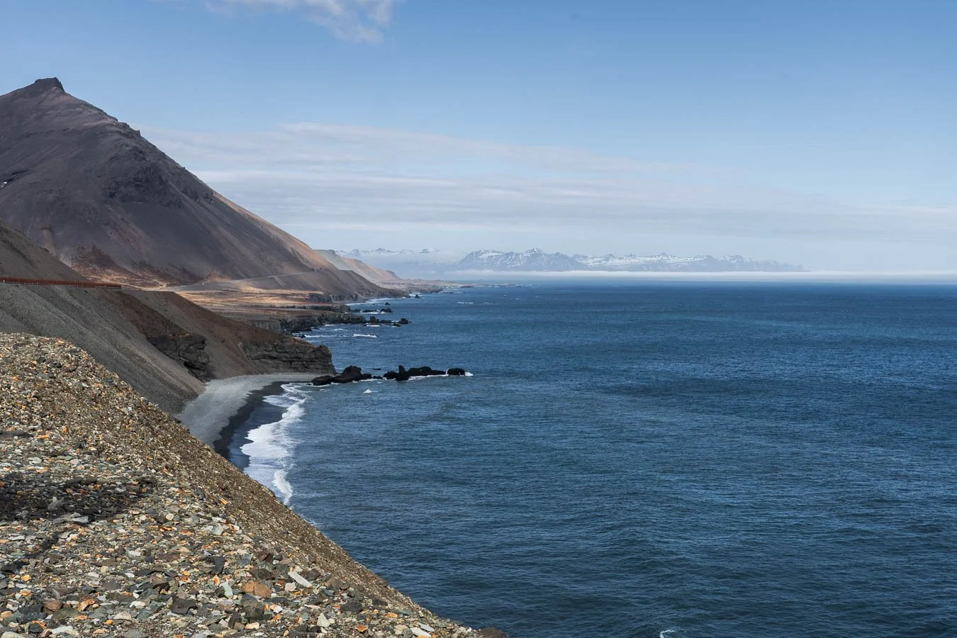
Cliffs and distant Reynisdrangar sea stacks as seen from the Víkurfjara Black Sand Beach.
Our next stop was the charming town of Vík, located near Reynisfjara Beach and the Reynisdrangar rock formations. From the nearby Víkurfjara Black Sand Beach, you can get a closer view of the sea stacks, which are steeped in Icelandic folklore (be aware of sneaker waves though). According to legends, these rocks were once trolls attempting to drag a ship to shore. When dawn broke, sunlight turned them to stone – a fate common in Icelandic fairy tales.

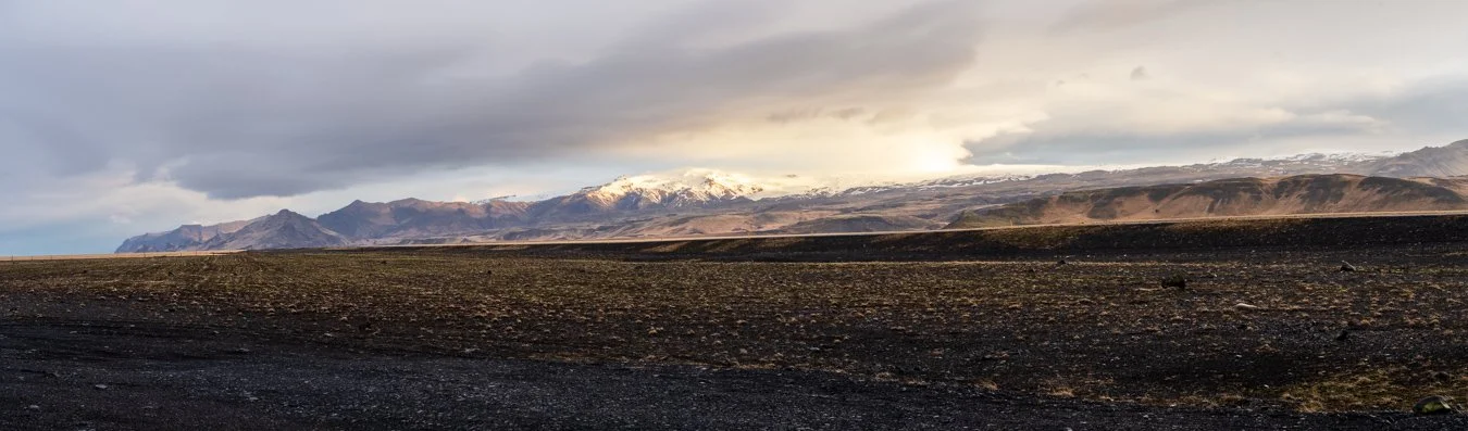
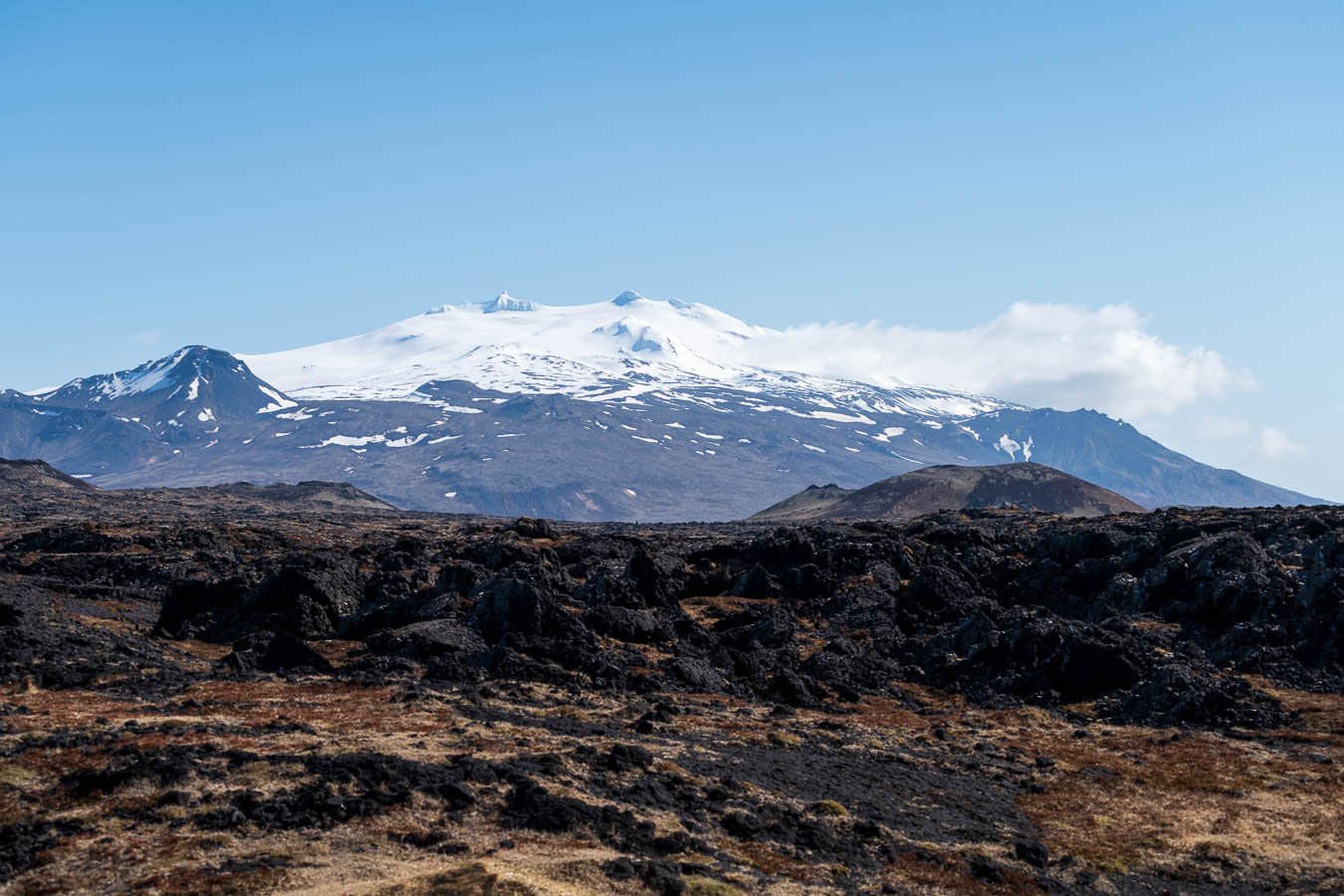
Mountain views along the Ring Road between Vík and Skaftafell Glacier.
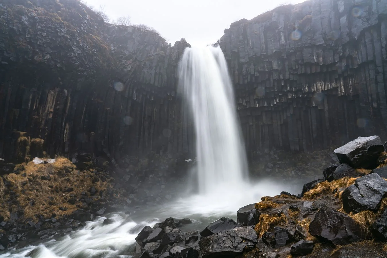
After resupplying and enjoying a quick coffee break, we continued along the Ring Road toward the Skaftafell Campground. We intended to explore the hiking trails around the Skaftafell Glacier, e.g. the hike up the Kristínartindar mountain, but were met with miserable weather that forced the closure of most trails. Fortunately, the popular trail to Svartifoss Waterfall was still accessible. Despite the rain, we hiked to the waterfall before warming up in our campervan and drying our clothes over dinner.
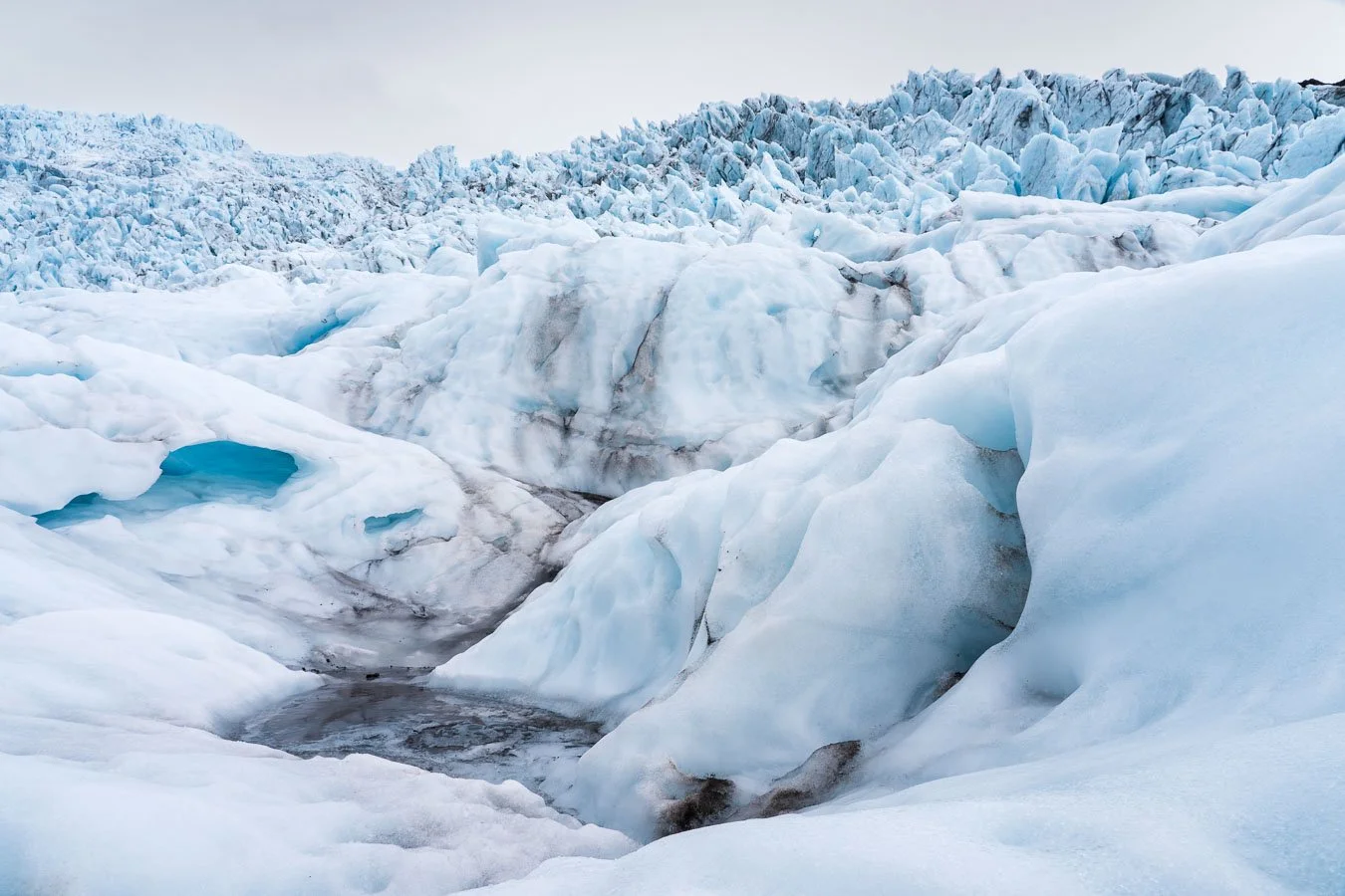
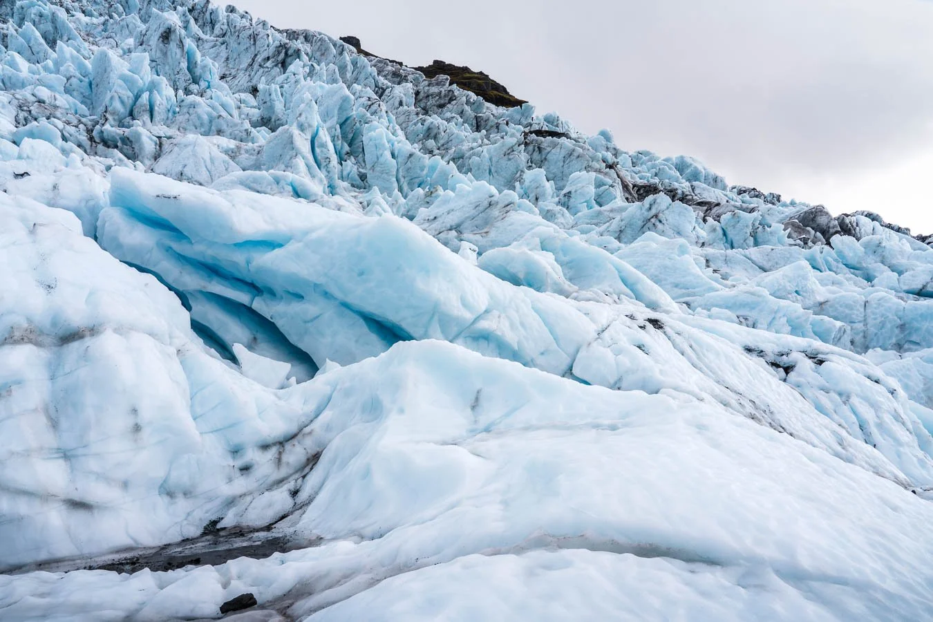
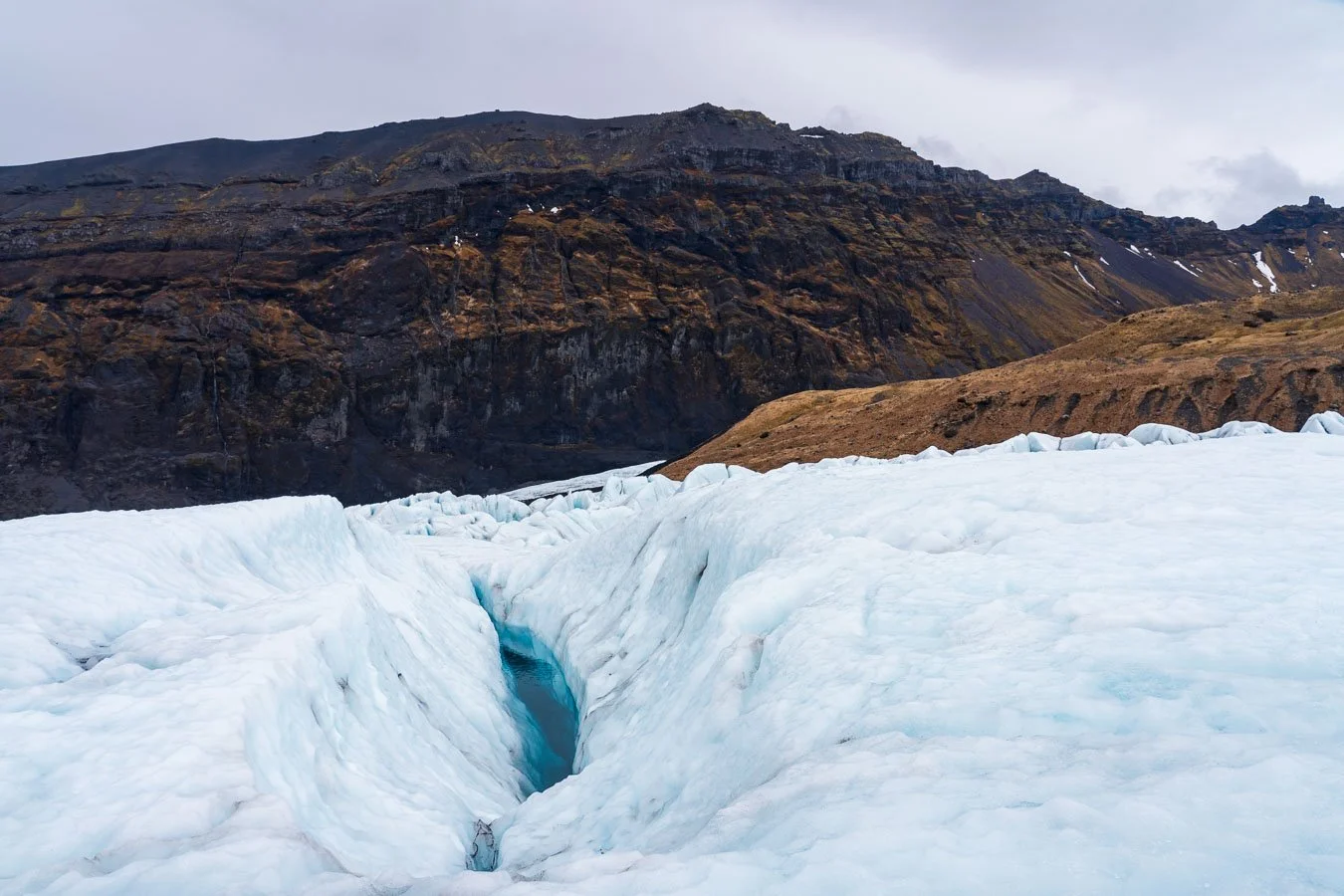
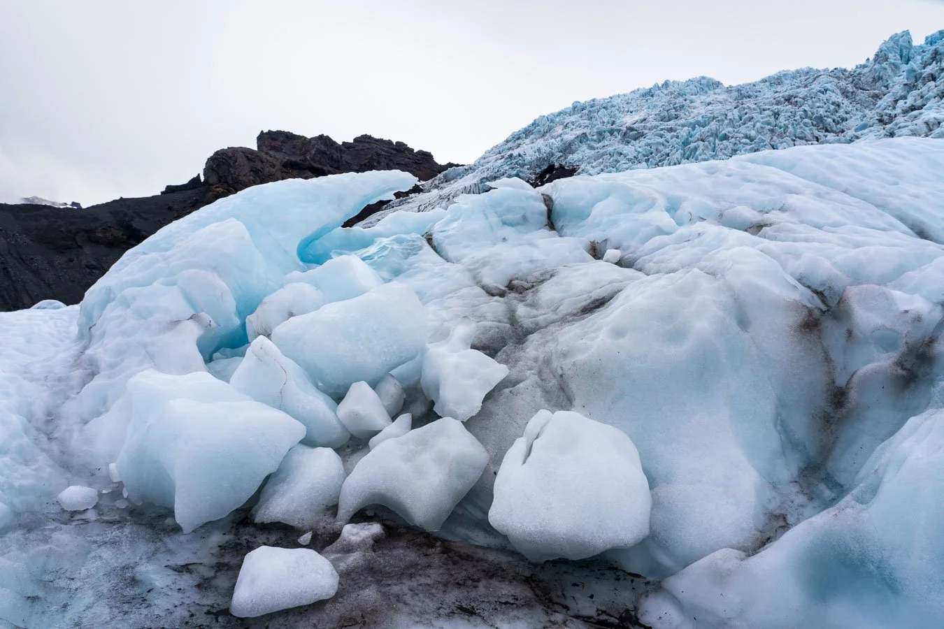
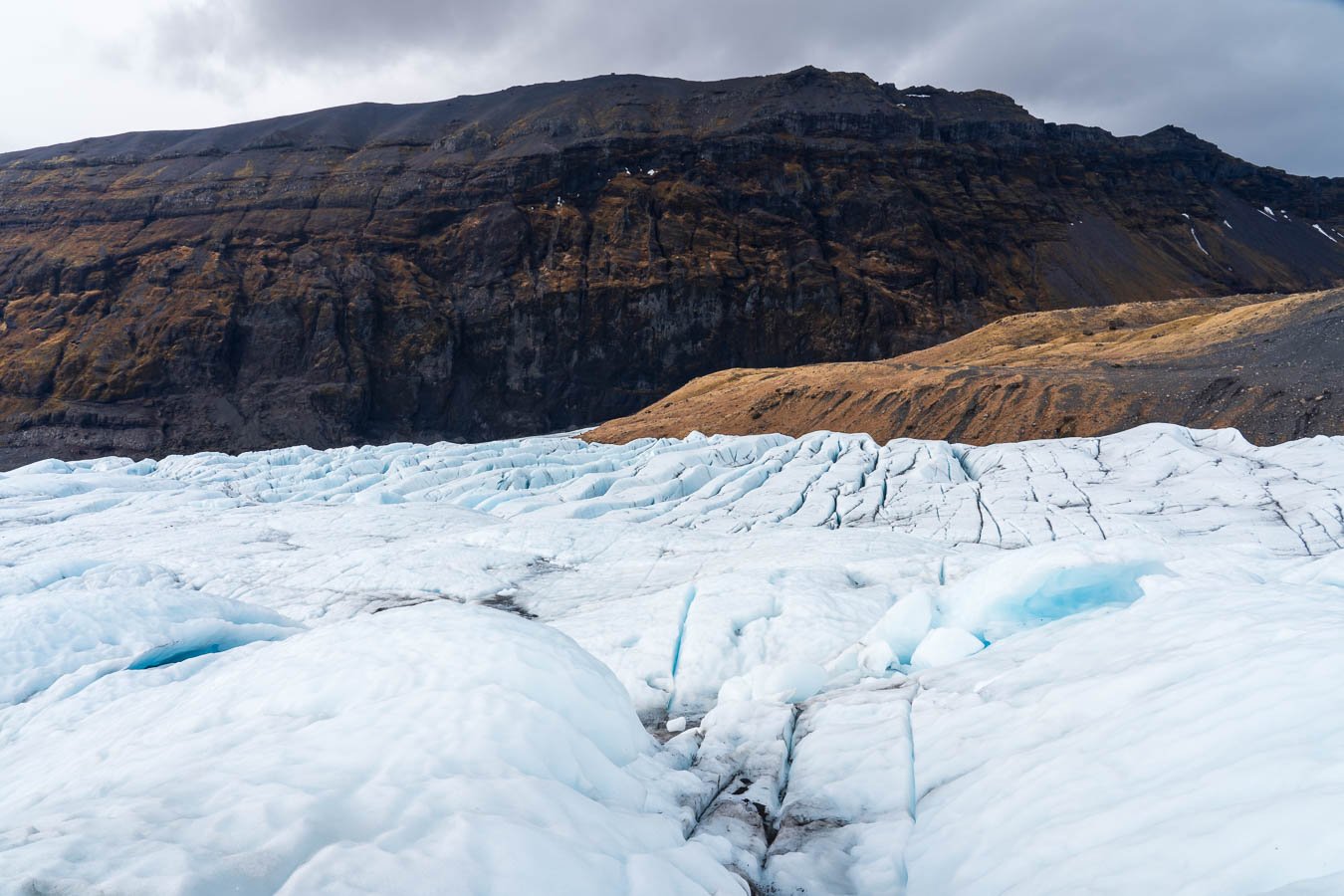
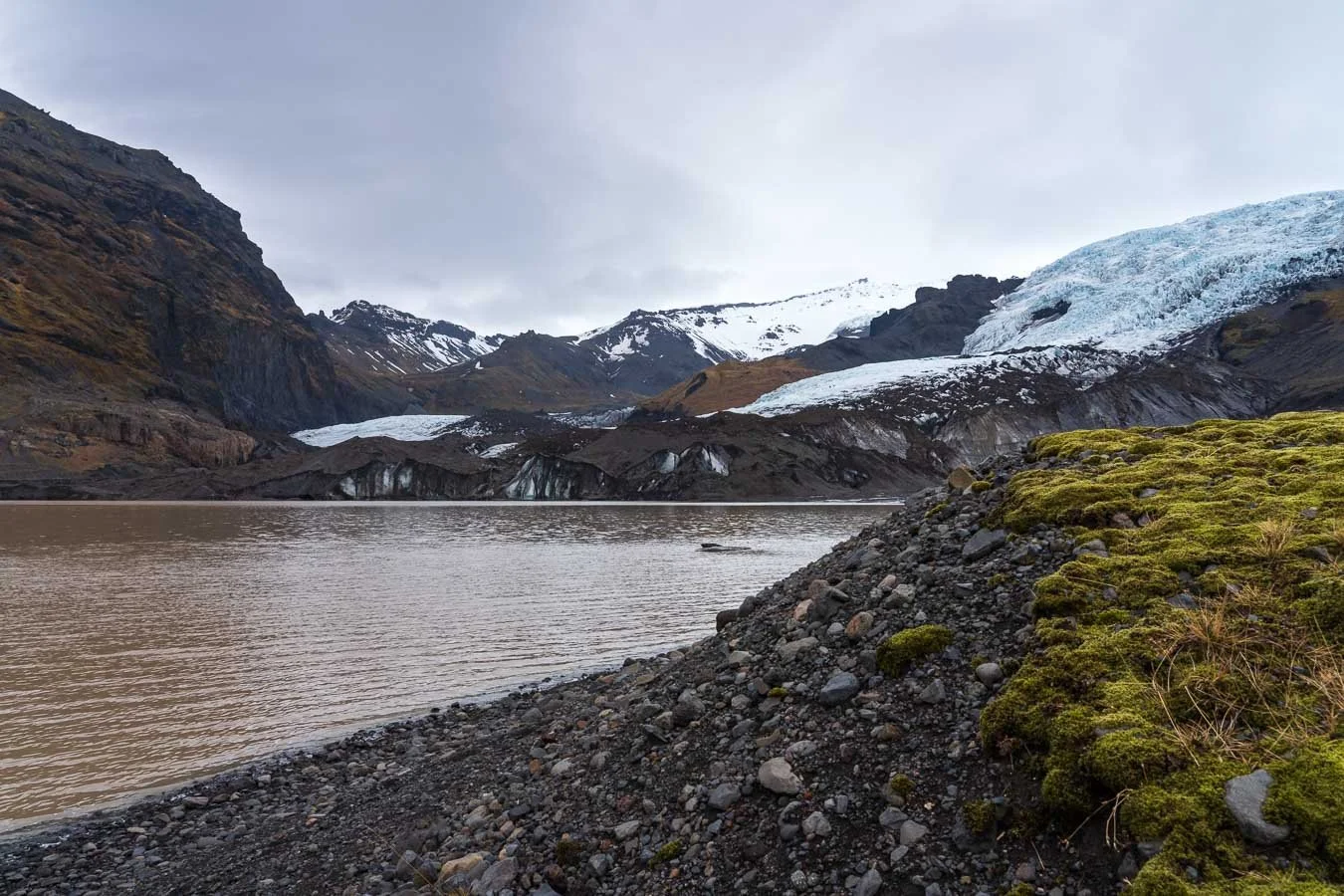
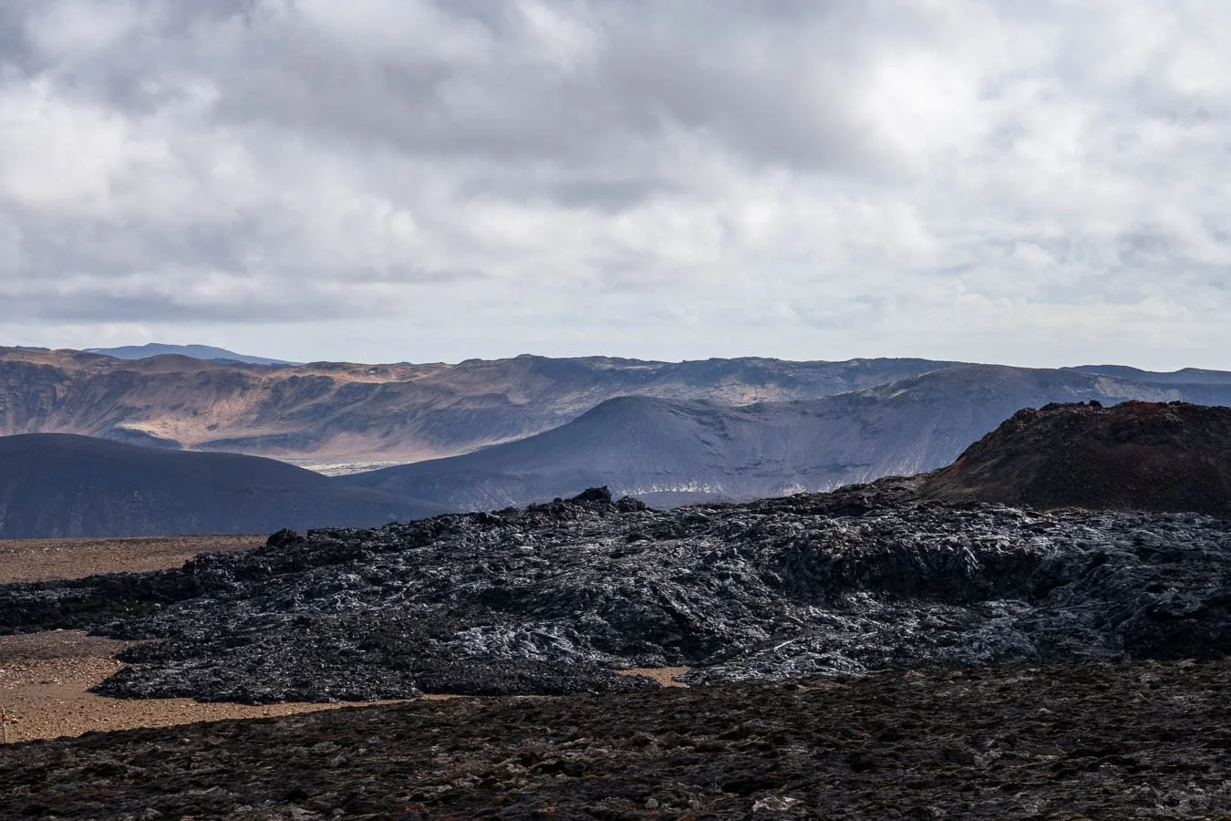
The weather forecast for the next day looked promising, so we booked a guided glacier hike. This region is home to several glaciers, and many tour companies offer hikes of varying lengths and difficulty levels. We opted for a 5–hour glacier tour on the Falljökull. After a short bus ride to the glacier’s base, our guides gave a quick introduction on how to use crampons and ice axes. The hike itself was spectacular. We explored crevasses and dramatic ice formations from up-close which turned this into one of the highlights of our Iceland trip. The surrounding cliffs and glacier plains offered breathtaking views, carved by the glacier’s relentless movement over the centuries.
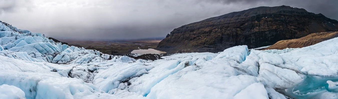
Panoramic view from our final point of the glacier hike on Falljökull.

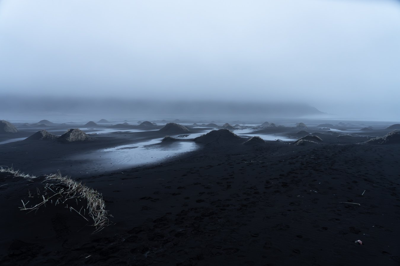
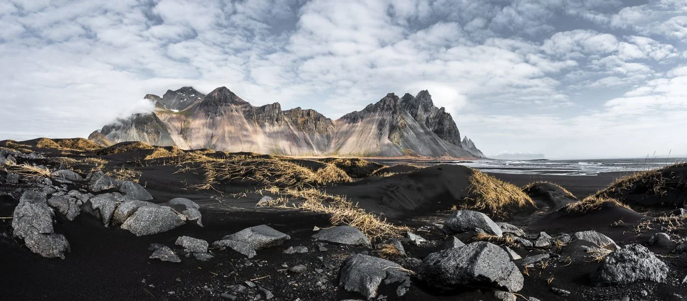
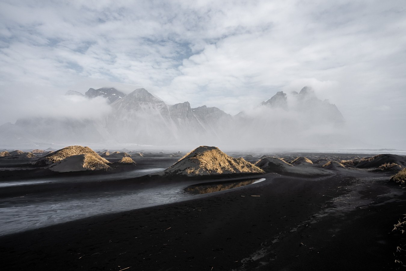
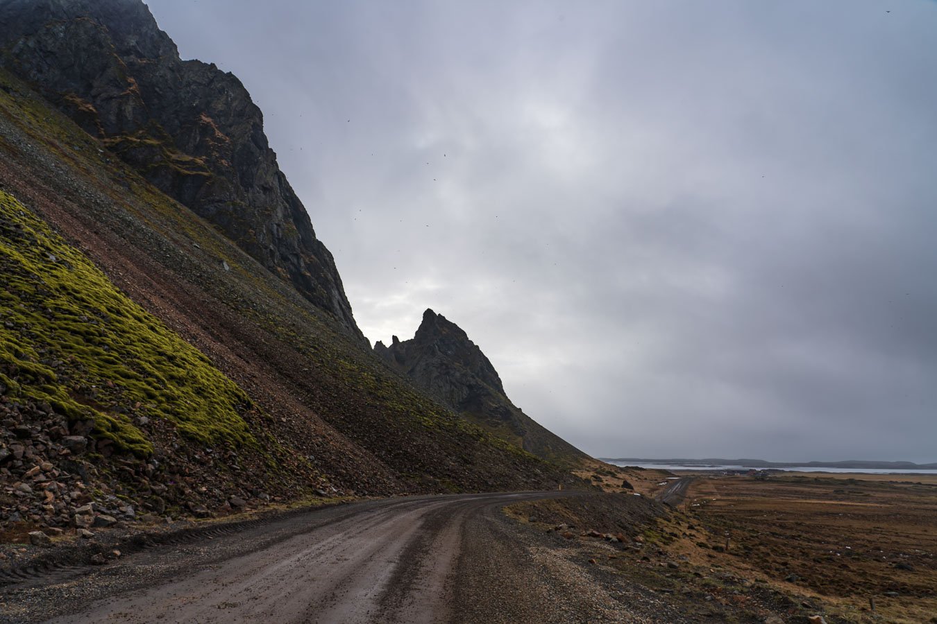
After returning to our car, we made our way to Höfn and the majestic Vestrahorn Mountain on the Stokksnes Peninsula (be aware that there’s a small entrance fee to access this private area though). We checked into a campground in Höfn and drove to Stokksnes in the evening, hoping to scout the area before sunrise. Unfortunately, the fog was so thick that we could barely see the mountain, though the eerie atmosphere made the former NATO radar station in the vicinity feel even more mysterious.
The next morning, we returned to Vestrahorn, only to find the sky still blanketed by thick clouds. After warming up with a coffee at the site’s café, we explored the area again, and eventually, the clouds began to part, allowing some light to pierce through and illuminate the peaks. Regardless of the weather conditions, the dramatic appearance of the mountain in combination with the surrounding black sand dunes, which further enhance the surreal atmosphere, render this location a must-see destination in our opinion. Even without a four-wheel drive vehicle (4WD), the gravel roads leading to the various parking areas were easy to navigate.
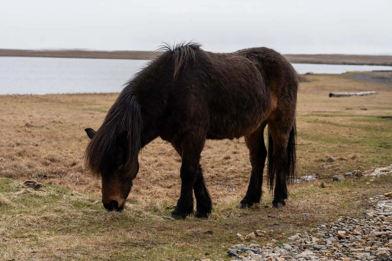
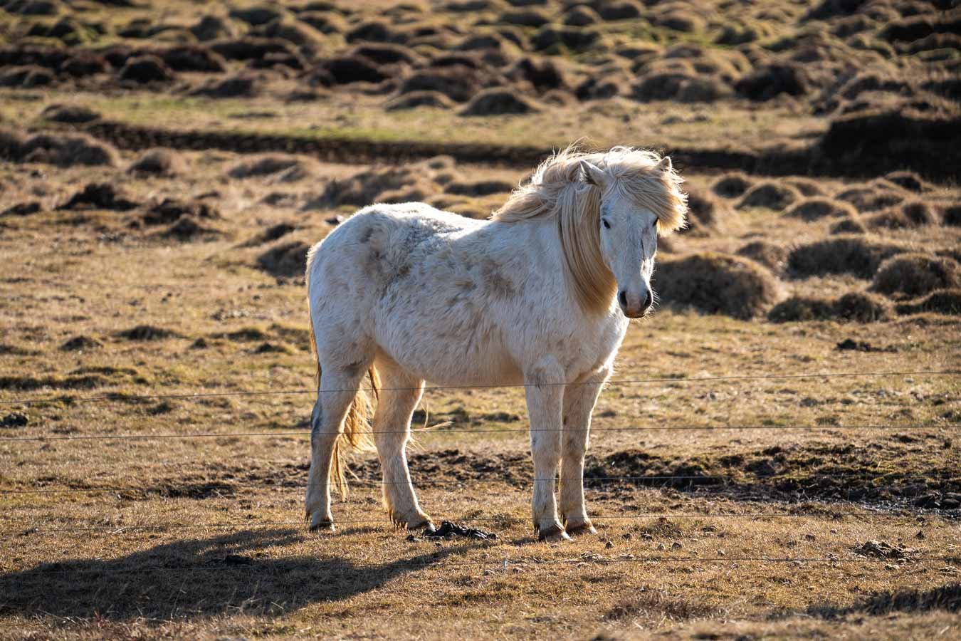
Interestingly, the area also served as a film set for the The Witcher series recently aired on Netflix. While not essential unless you’re a fan of the show, it’s still a fun detail. If you’re lucky, you might even spot some Icelandic horses roaming nearby fields, which added to the experience!
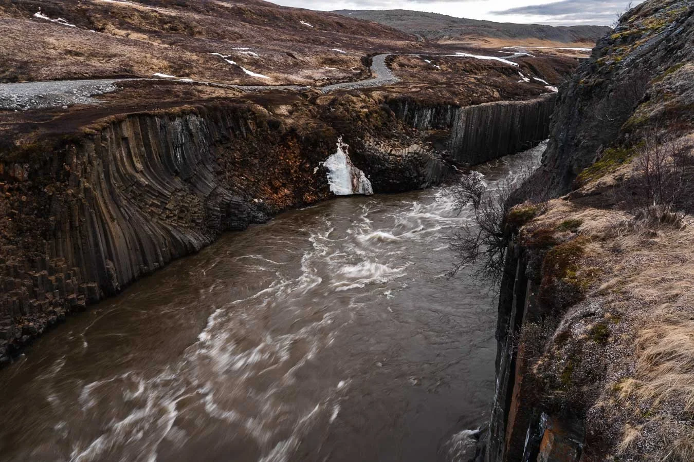
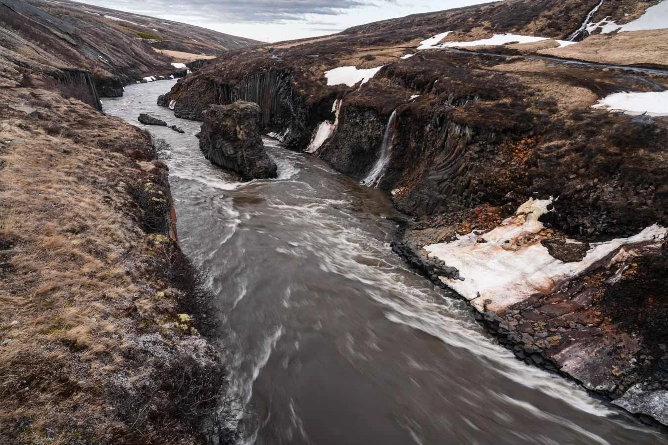
Around noon, we continued our journey. We had originally planned to visit Hengifoss Waterfall but unfortunately had to skip it due to time constraints, as we also wanted to reach Stuðlagil Canyon before nightfall. Accessing the canyon requires driving roughly 20 km on a dirt road from the Ring Road.
Stuðlagil Canyon can be approached from both the east and west banks. The western side offers a viewing platform with panoramic views, while the eastern side allows you to hike down into the canyon between its striking basalt columns. Since we visited in mid-April, water levels were rather high, likely due to glacial melt and heavy rains in the days prior. As a result, the usually turquoise-blue river appeared brown and muddy. While researching in advance, we read that the dirt road to the eastern car park could be challenging due to poor conditions, which made us hesitant given our heavy campervan. Since Stuðlagil Canyon wasn’t a top priority for us, we chose the western side for a quick stop, avoiding the risk of getting stuck in the mud. Additionally, the western car park has a campsite, though it was still closed for the season. If this canyon is high on your list, visiting later in the year is likely to offer the best experience – namely late June to early August, when water levels are lower and the river usually returns to its stunning blue hue. Furthermore, consider staying overnight at the western campsite then, as this would allow more time for its exploration.
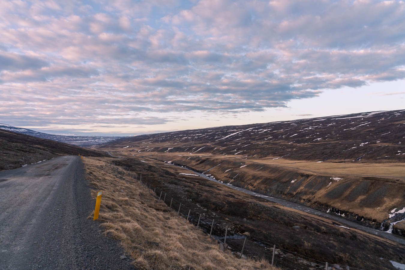
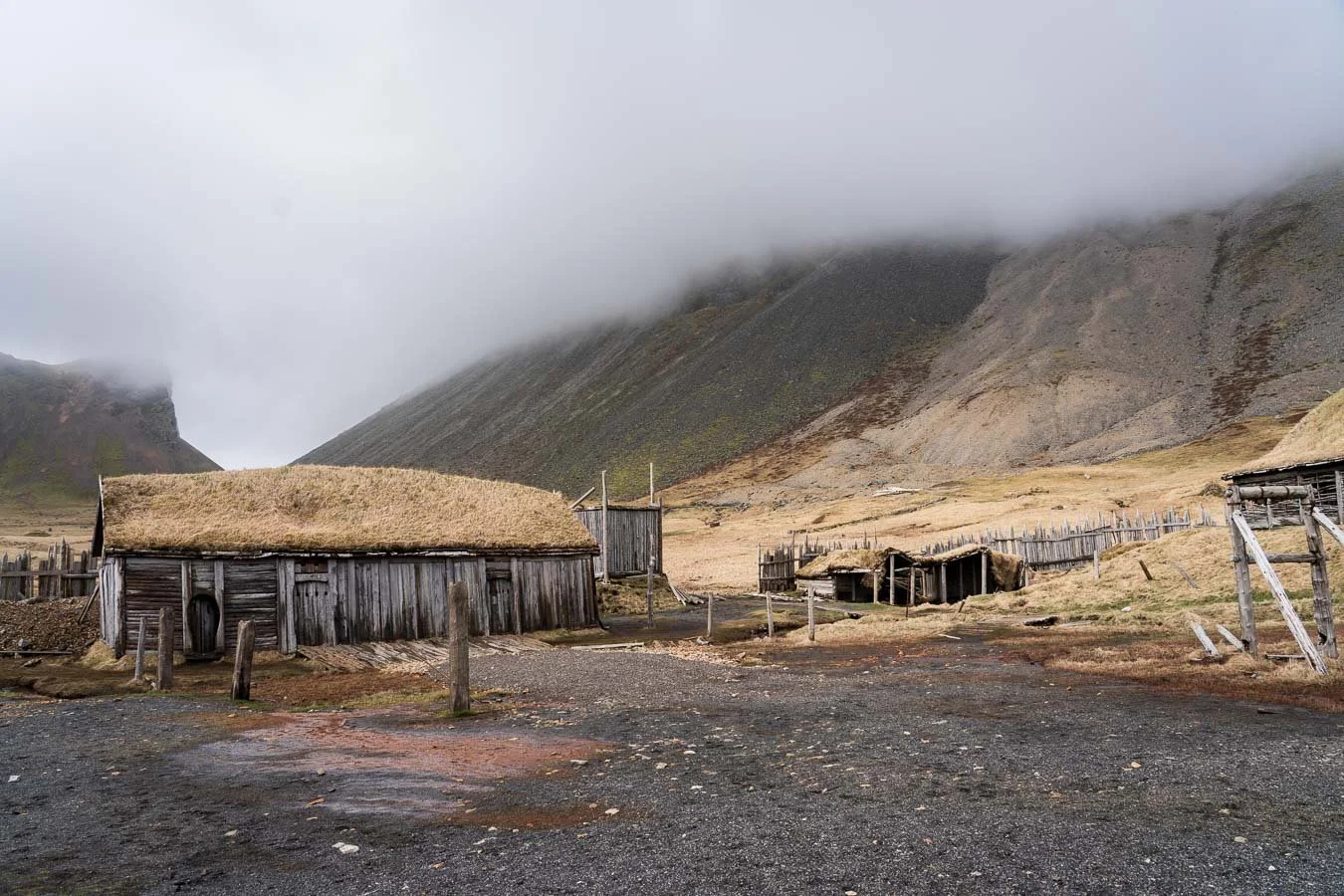
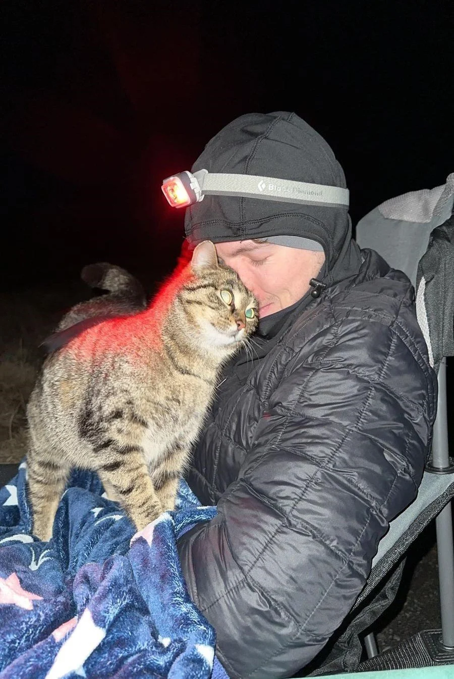
We then headed toward the remote Campground Fjalladyrð/Möðrudalur, located several kilometers inland from the Ring Road. Although the drive there is on a dirt road, it was well-maintained and easily manageable with a 2WD vehicle. The farm setting was idyllic, with sheep, a friendly farm dog, and a curious cat greeting us upon arrival.
After settling in, we took advantage of the remote location to search for auroras, as the night’s KP-index (a measure of solar particle radiation's disturbance of Earth's magnetic field, thereby providing an estimate of aurora likelihood) was forecasted to be high with clear skies. We set up our camping chairs in a nearby field and patiently waited under the vast, star-filled sky. The farm cat followed us there, exploring the field before jumping into our laps to warm up – an absolutely adorable and unforgettable moment! Despite the beautiful night sky, we weren’t lucky enough to spot any northern lights.
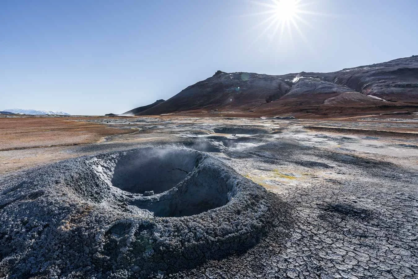
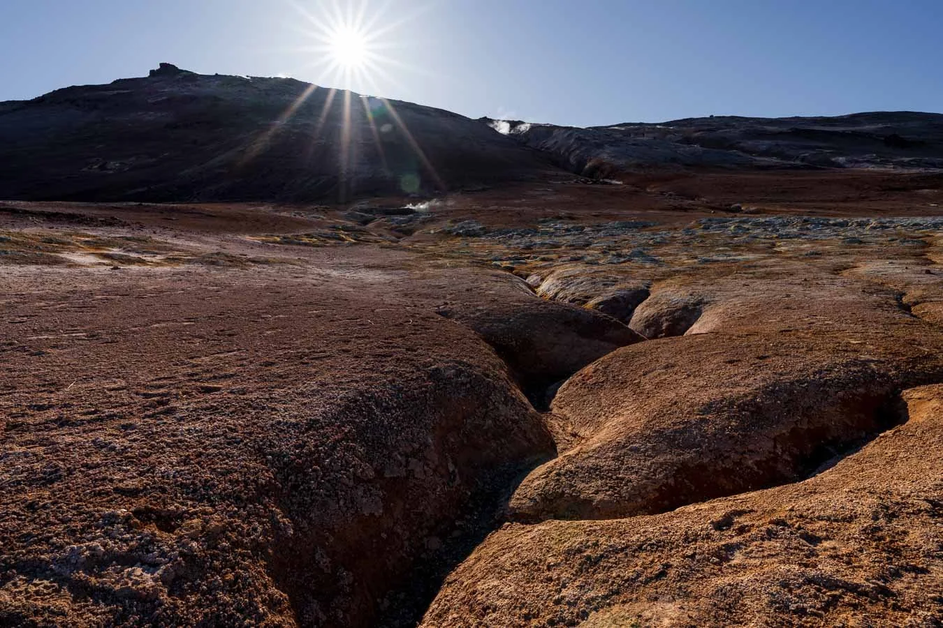
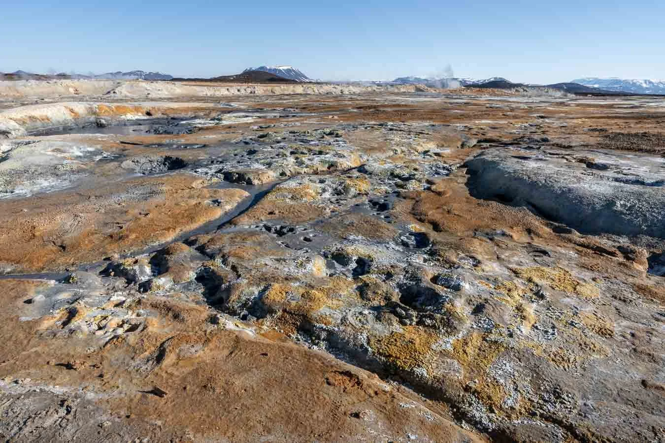
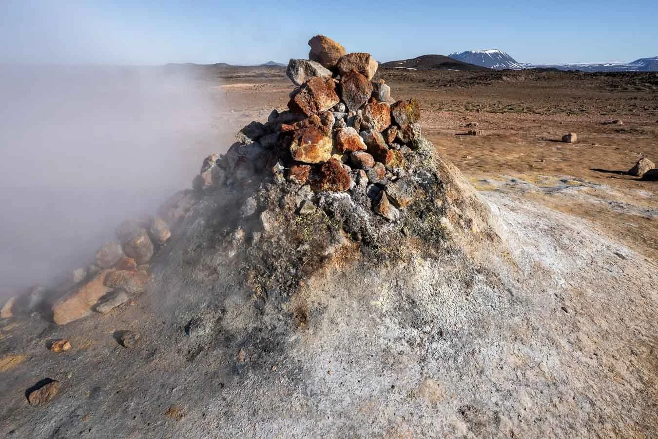
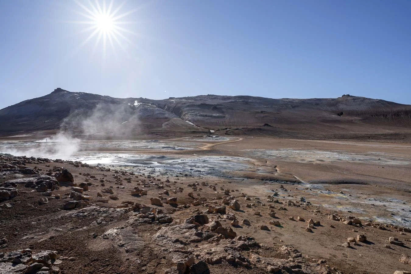
The next morning, we headed northwest along the Ring Road toward the geothermal area near Reykjahlíð. This region has several must-see geothermal attractions. Our first stop was Námafjall, located directly off the main road. The site features sulfuric fumaroles, bubbling mud pools, and pseudocraters, yielding a surreal, almost lunar-like landscape. Exploring the various trails takes about 1–2 hours, depending on how much time you spend admiring the geothermal features.
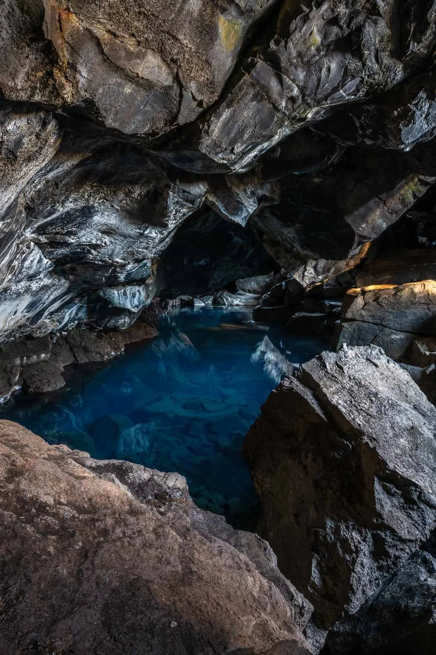
We then visited the Grjótagjá Lava Cave near Lake Mývatn. Formed by volcanic activity, this small cave features impressive lava formations and a crystal-clear, hot blue pool. Swimming is prohibited due to the water’s unpredictable and dangerously high temperatures, which can exceed 50°C. The cave also gained popularity after being featured in the TV show Game of Thrones, further adding to its appeal. Nearby is also the Hverfjall Volcano Trail, a hike leading to the rim of a large volcanic crater. While this trail looked intriguing, we opted to skip it in favor of something more unique – a horseback-riding tour along Lake Mývatn's shores.
We booked a ride with a local farm run by a lovely older couple. As it was still the off-season, we were the only participants, making for a very personalized experience. After gearing up and learning how to prepare the Icelandic horses, we set off toward the lake. Since it was my first-ever horseback-riding experience, I decided not to bring my camera and focus entirely on the ride. Our guide explained how to control the different gaits of Icelandic horses, including the unique Tölt, which is smooth and fast. At one point, my horse even decided to show off its gallop! The guide also shared stories about the various bird species native to the Lake Mývatn area, making this tour perfect for anyone interested in birdwatching. We stayed the night at the Hlíð ferðaþjónusta Campground in Reykjahlíð before heading to Húsavík the following day.
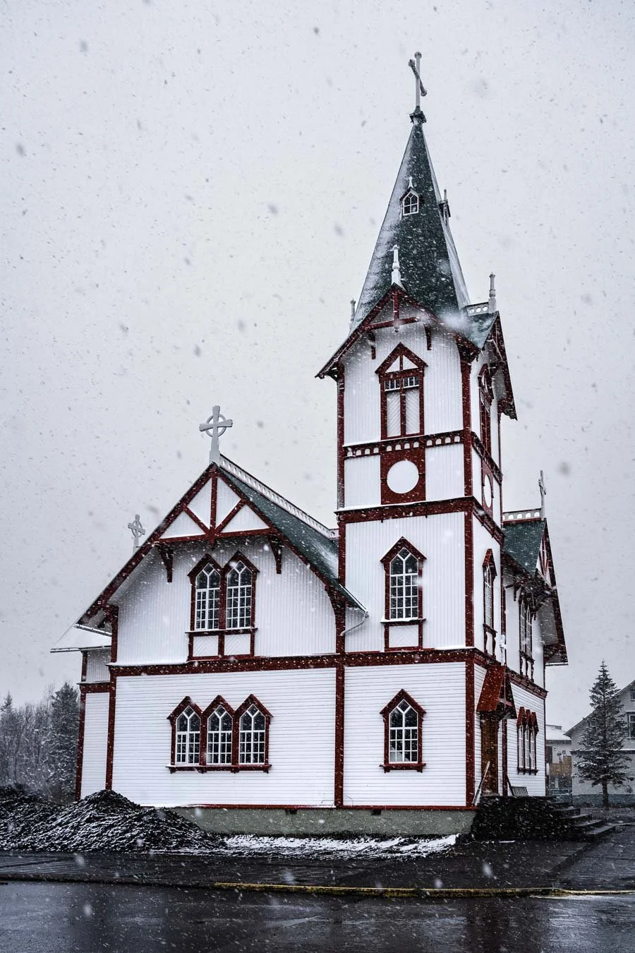
The iconic Húsavík Church, a Norwegian-style wooden structure, during heavy snowfall.
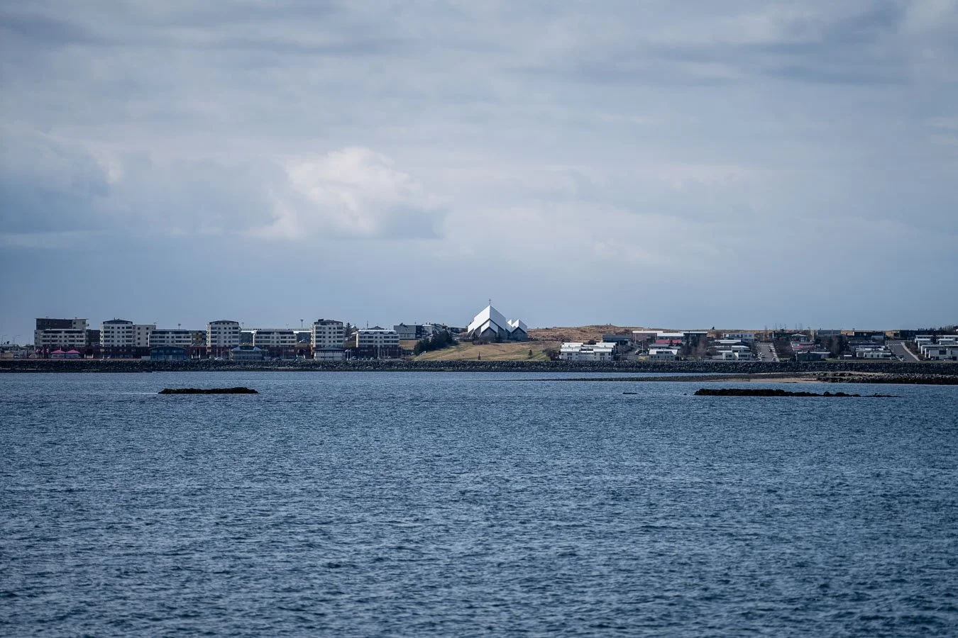
We had planned a whale-watching tour from Húsavík, a town often referred to as the ‘whale-watching capital of Iceland’ due to the variety of whale species frequently spotted in nearby Skjálfandi Bay. Unfortunately, the tour was canceled due to bad weather, with heavy snow and strong winds sweeping through the area. Instead, we visited the excellent Húsavík Whale Museum, where we explored whale skeletons and learned about the biology, migration patterns, and conservation efforts related to these magnificent creatures. The museum provided a great educational experience and was a worthwhile alternative on a stormy day. Húsavík is not only famous for whale-watching but also serves as a departure point for boat tours to Flatey Island, a breeding ground for puffins during the summer months. After our museum visit, we enjoyed a small lunch and a warm coffee at one of the many cozy cafés before continuing our journey westward.
We diverted from the Ring Road to visit one of Iceland’s smaller, less touristy hot pools. While the Blue Lagoon is by far the most popular geothermal spa (thanks to its proximity to Keflavík International Airport) there are numerous other hot pools across the island that are less crowded and often located in more scenic settings.
Taking the detour along Road 745 rewards you with scenes like this.
One such place is Reykir – Grettislaug, about a 45-minute drive from the Ring Road. The last 15 minutes involve navigating a bumpy dirt road, though it’s manageable even with a 2WD camper. Upon arrival, we were greeted by a lovely elderly man who runs the site. Entrance cost 2,000 ISK per person (at the time we visited) and granted us access to the hot pools, showers, and toilets. Alternatively, you can just spend time in the small cozy café/bar and socialize with other visitors or talk to the owner. Visiting in mid-April, we found the site nearly empty, making for a peaceful and relaxing experience. While it’s possible to stay overnight at the campsite, we needed to continue our journey westward.
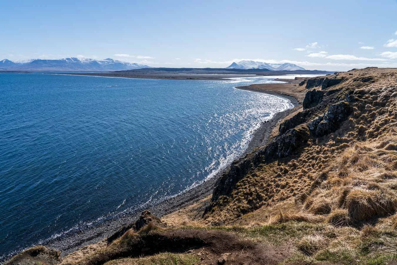
Instead of returning to the Ring Road, we took a scenic detour via Road 745 (dirt road), which follows the island’s northern coast. The drive offered spectacular coastal views, though the dirt road can be rough in places. Thus, it’s a good idea to check the current road conditions online before heading out, especially during the colder months.

Road 745 offers not only stunning views of dramatic coastal cliffs but also a peaceful escape from the crowds, making it a great way to experience the untamed beauty of North Iceland in solitude.
One of the main reasons we chose this route was to visit the Kálfshamarsviti Lighthouse and its basalt column formations. Unfortunately, by the time we arrived, the sun had already set and the weather had turned cloudy, so we only stopped briefly to cook dinner before continuing to our campsite. The road leading to the lighthouse was quite bumpy and poorly maintained at the time, so unless you’re particularly keen to see the lighthouse, sticking to the Ring Road might be a better option. We spent the night at the Glaðheimar Campsite in Blönduós, which offers basic facilities and online payment options.
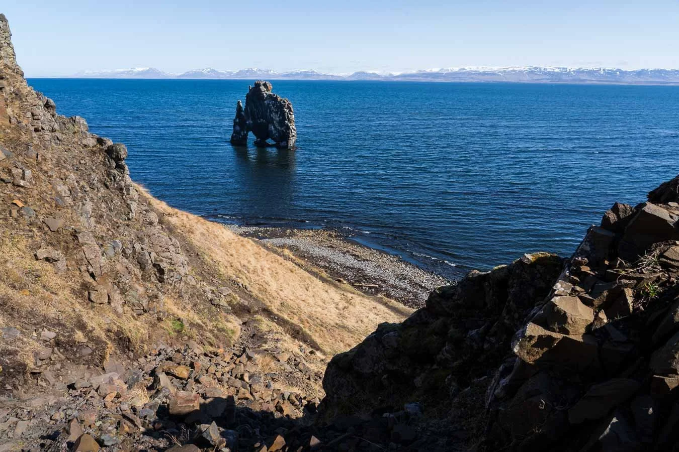
The iconic Hvítserkur sea stack along North Iceland’s coastline.
The next morning, we took another detour to visit the Hvítserkur rock formation, also known as the ‘Petrified Stone Troll’. Reaching the site requires a 30-40 minute drive (about 26 km) along Road 711 (dirt road). While the road itself was manageable, the access road to Hvítserkur’s car park was in poor condition. Even with our campervan’s higher ground clearance, driving down the road wasn’t exactly confidence-inspiring. If you have a smaller 2WD vehicle, you may have a tougher time navigating it. After safely making it to the car park, it was a short walk to the viewing platform overlooking Hvítserkur. While the formation itself is impressive, we wouldn’t recommend going out of your way unless you have plenty of time or are particularly interested in seeing it. We found the distant cliffs in the surrounding area even more striking than Hvítserkur itself.
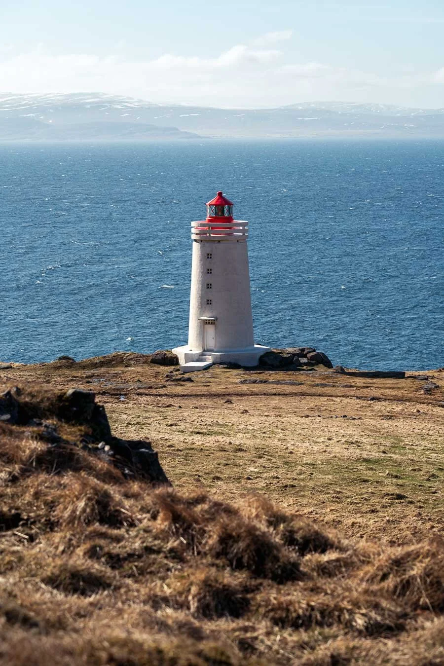
A quick but beautiful stop, Skardsviti Lighthouse along Road 711.
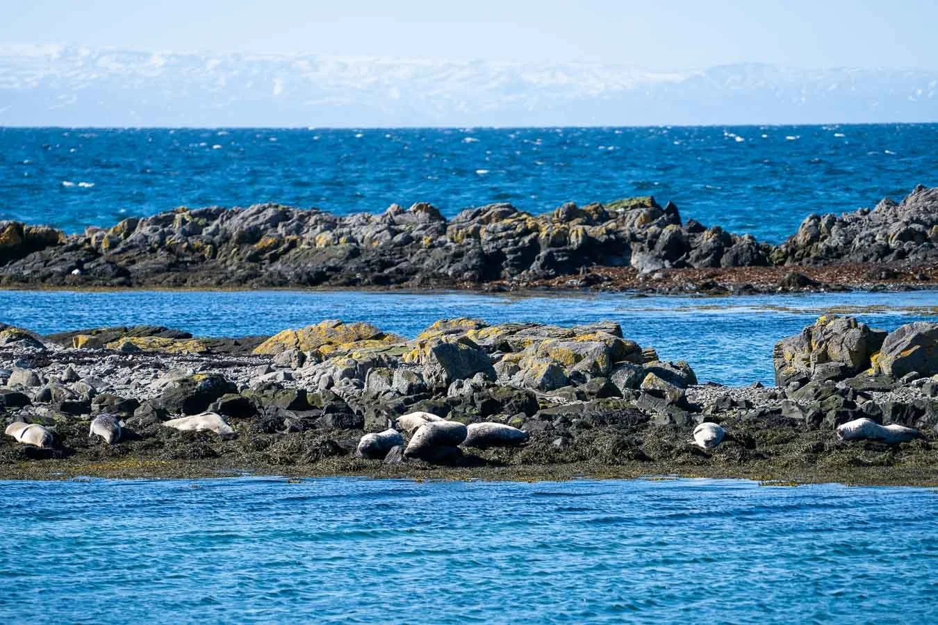
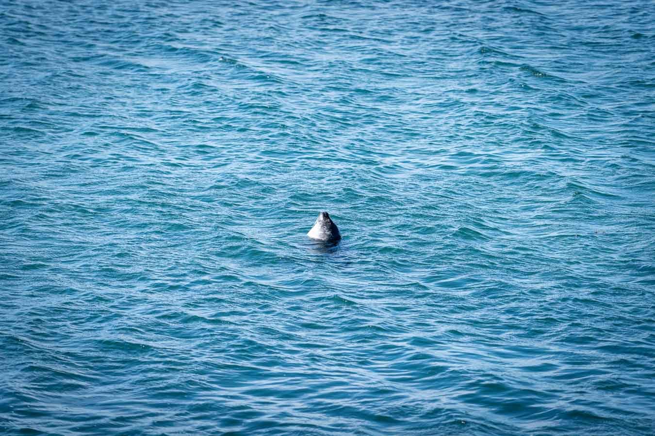
Rather than backtracking, we continued along Road 711 counterclockwise to eventually rejoin the Ring Road farther west. Along the way, we stopped at the Skardsviti Lighthouse, a cute little lighthouse easily visible from the roadside. Along this road, you will also pass Illugastaðir, a well-known seal observation deck offering the chance to spot seals lounging on the coast. We had also hoped to visit a nearby factory shop selling authentic Icelandic wool sweaters (KIDKA Wool Factory Shop) but it was unfortunately closed the day we wanted to visit.
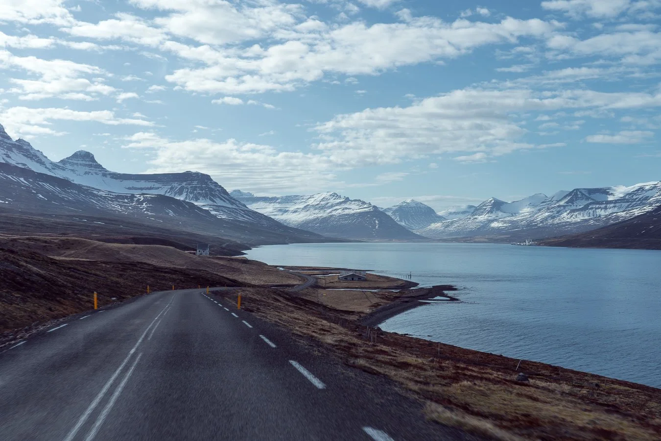
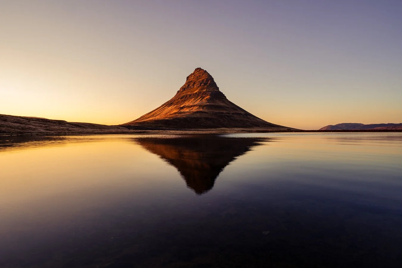
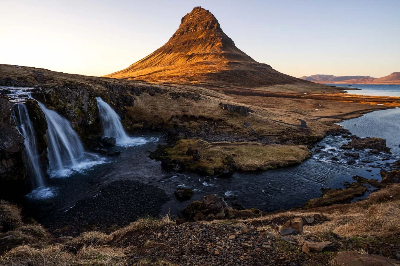
Our next destination was the Snæfellsnes Peninsula and the iconic Kirkjufell Mountain. The drive from Skardsviti to Grundarfjörður took us through some stunning coastal landscapes along Roads 54 and 60. While sections of these roads are gravel, they were manageable with our campervan. Traffic was light, so avoiding potholes was fairly easy. If you’re concerned about road conditions or driving a lower-clearance vehicle, you can stick to Route 1 and approach the Snæfellsnes Peninsula from the south via Roads 54 and 56.
After checking in at Campground Grundarfjörður, we headed straight to the Kirkjufell car park for sunset. The short walk from the car park leads to the famous viewpoint of Kirkjufellsfoss Waterfall in front of Kirkjufell. Its easy access and Game of Thrones fame make this site particularly popular, so expect it to be busy year-round. If you walk a bit further, you’ll find a small pond offering beautiful reflections of Kirkjufell on calm, less windy days.
We had considered returning later that night to try our luck at spotting northern lights above Kirkjufell. However, with only moderate aurora forecasts and an incoming cold front bringing strong and icy winds, we decided to stay warm in our campervan instead. Campground Grundarfjörður offers basic facilities and online booking through signs posted on-site. While the campsite itself isn’t particularly memorable, its convenient location near Kirkjufell makes it a practical base for catching sunrises, sunsets, or northern lights over the mountain.
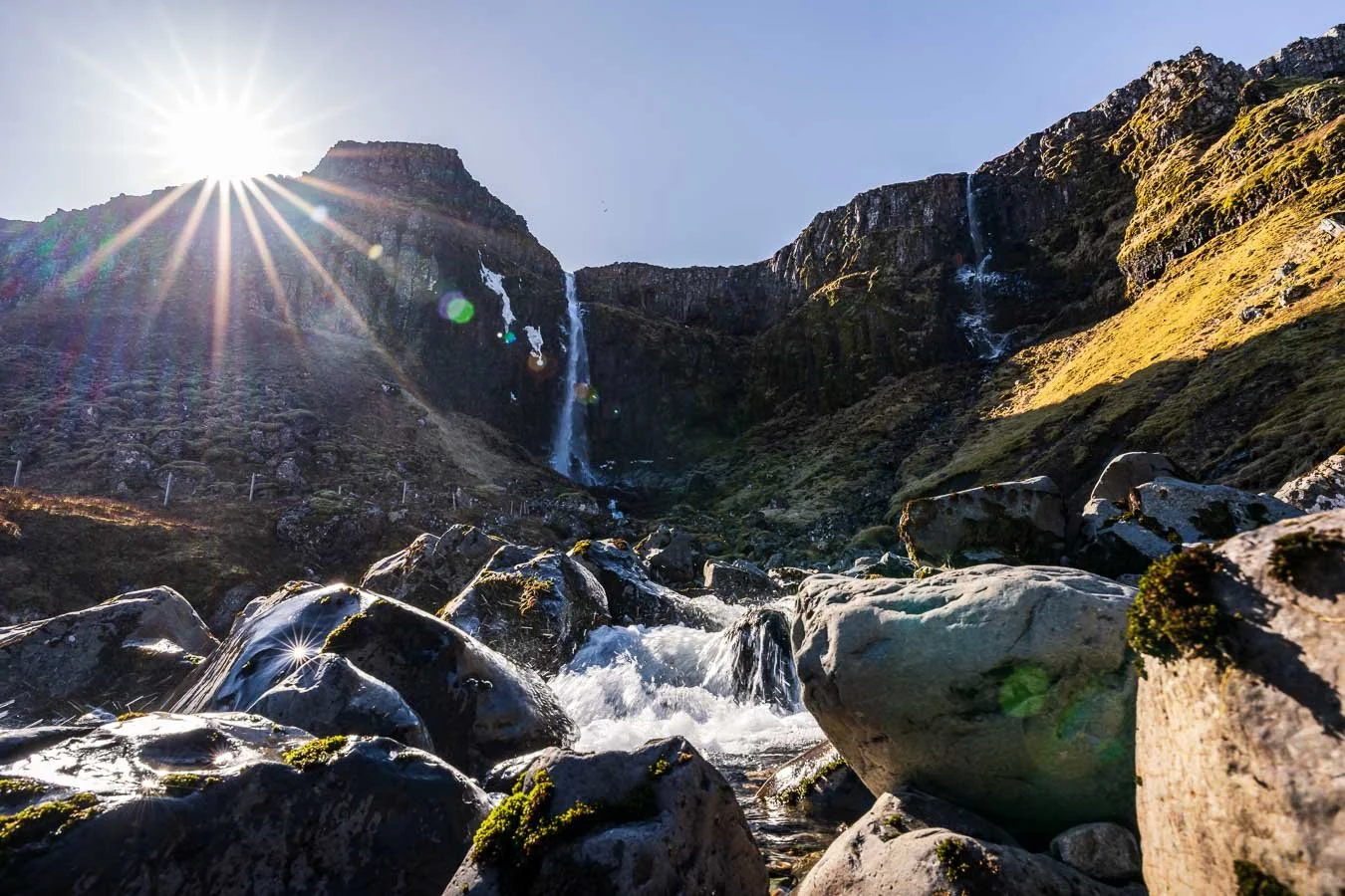
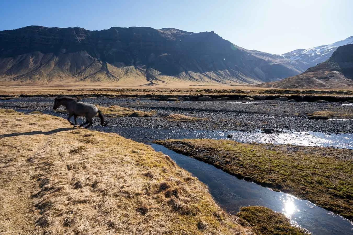
The following morning, we took a short backtrack to visit Grundarfoss Waterfall. Its gravel car park is located right off the main road and is free to access. From there, it’s a short 20-minute walk to the waterfall itself. This spot felt idyllic and peaceful, especially compared to the much busier Kirkjufell area. With fewer tourists around, we were able to enjoy the stunning landscape in relative solitude. A few Icelandic horses were grazing nearby, making for some picture-perfect moments. If you’re already visiting Kirkjufell and have extra time, Grundarfoss is definitely worth a stop.
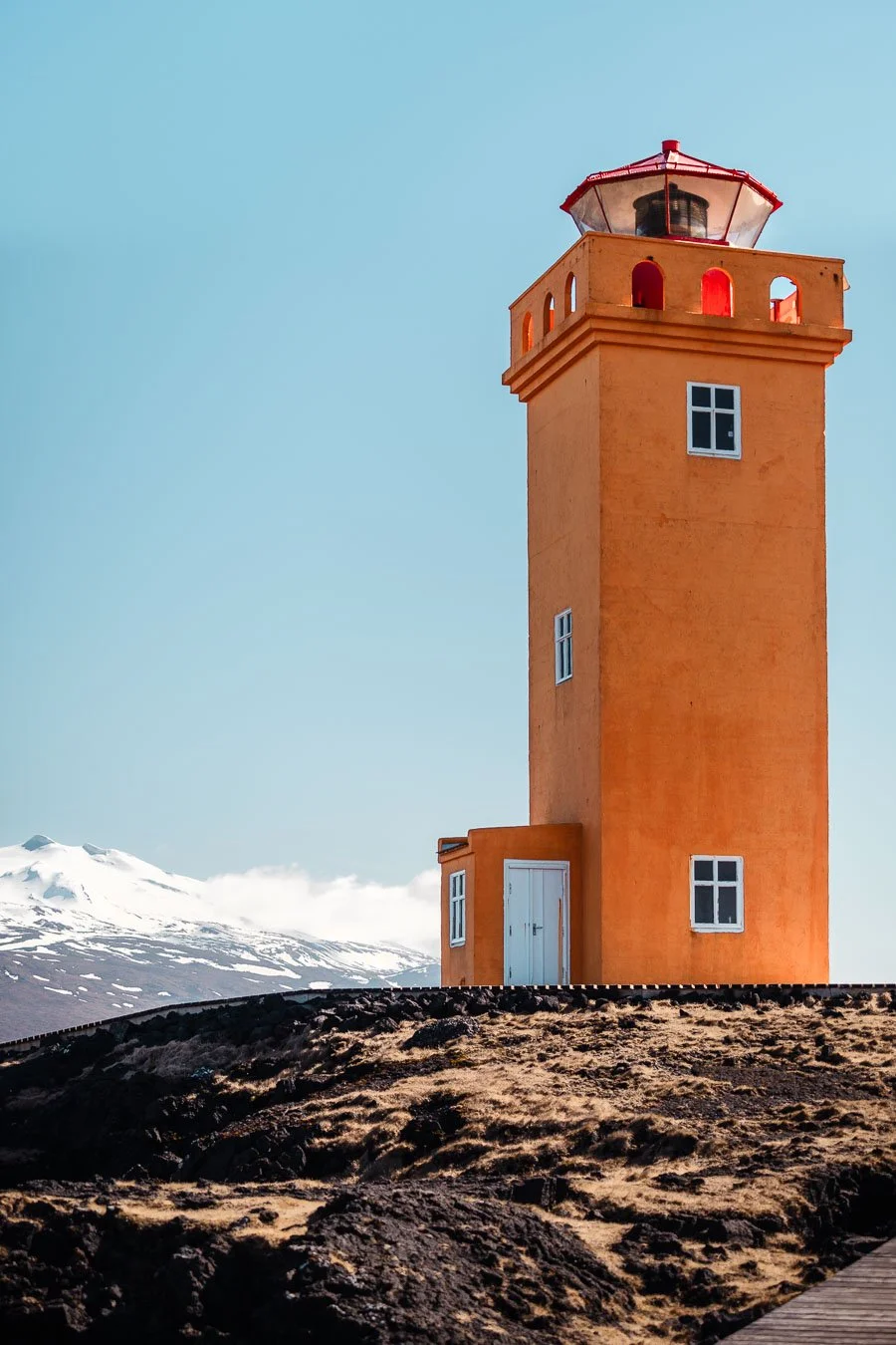
Our next stop was the iconic, brightly orange colored Svörtuloft Lighthouse. However, the road leading there turned out to be quite challenging. The roughly 6 km-long dirt road was narrow, winding, and in rather poor condition when we visited, with plenty of rocks and potholes. The small car park near the lighthouse only fits about 5–6 cars and offers no facilities besides a picnic table. Given the road’s condition, a 4WD vehicle with high ground clearance is recommended, especially when navigating around other cars coming from the opposite direction. However, once you arrive, the lighthouse and surrounding views are quite scenic, and you may even spot various bird species nesting in the steep cliffs nearby.
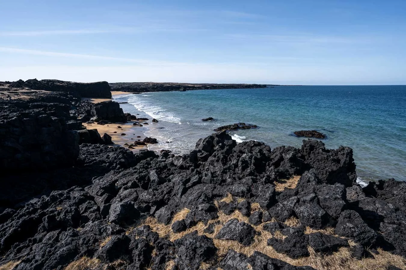
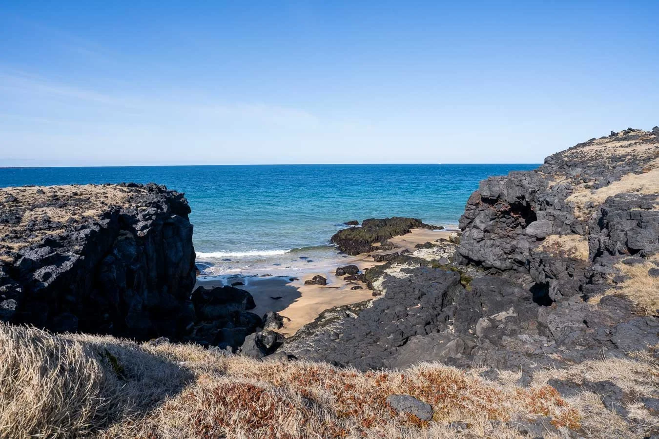
On the way to the lighthouse, we passed Skarðsvík Beach, a unique sandy beach with golden sand, unlike the more common black volcanic beaches found throughout Iceland. This beach also features some impressive rock formations, making it a worthwhile stop if you’re already heading to the lighthouse and equipped with an appropriate vehicle. Otherwise, there are numerous lighthouses throughout the island that are easier to reach.
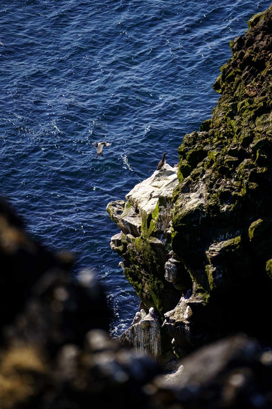
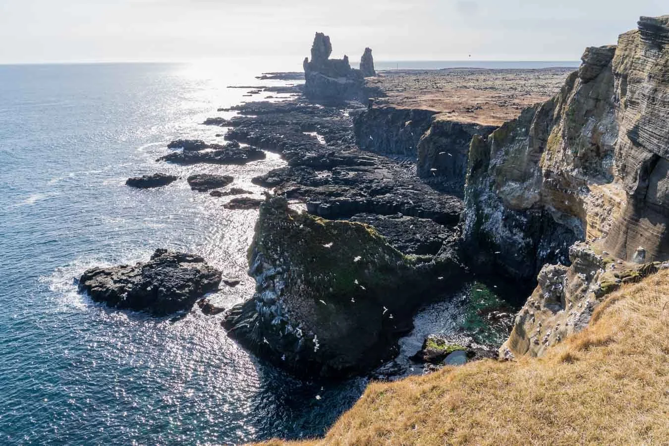
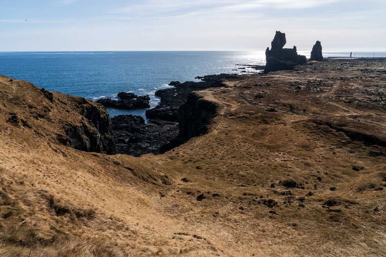
Another beautiful location on the Snæfellsnes Peninsula is the Lóndrangar Viewpoint. The car park (with no facilities) is located directly off the main road and connects to a short gravel trail leading to the viewpoint. The views over the volcanic sea cliffs – particularly Lóndrangar and Malarrif Lighthouse – are beautiful. These cliffs are home to large bird colonies with species like puffins, fulmars, common murres, and kittiwakes (be sure to check the particular breeding times though, e.g. typically late April to August for puffins). The coastal views are breathtaking, but the inland vistas of Snæfellsjökull Glacier are just as spectacular. This spot makes for a great short stop while exploring the peninsula.
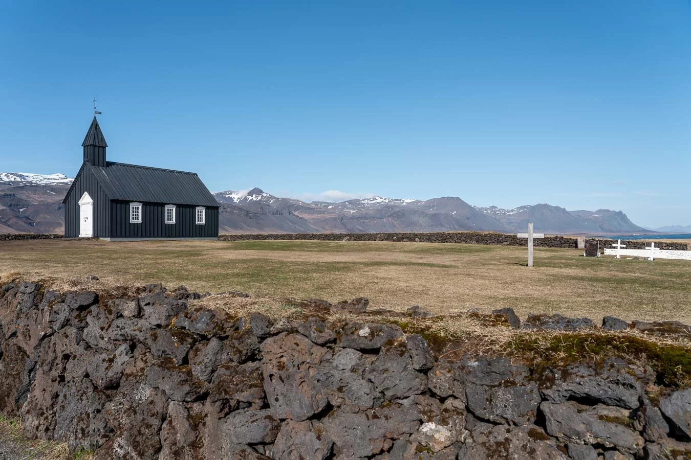
Búðakirkja, a historic black church on the Snæfellsnes Peninsula, rebuilt in the 19th century and now an iconic Icelandic landmark.
Our next stop was the Búðakirkja Black Church, a small wooden church dating back to the 19th century. Its scenic location near the coastline of the Snæfellsnes Peninsula, combined with its unique black exterior, makes it popular among photographers. The car park is located right next to the church, allowing easy access to the surrounding area, including the historic graveyard. Despite its remote feel, the church tends to get busy even in the off-season, so if you want tourist-free photos, be prepared to wait patiently.
After exploring the Snæfellsnes Peninsula, we intended to spend the final two days of our trip in Reykjavík. Hence, we left early in the afternoon to cover the 180 km drive (about 2 h 30 min) toward the capital. The journey itself was pleasant, with picturesque mountain ranges making the drive enjoyable.
We considered hiking to Glymur Waterfall, one of Iceland’s tallest waterfalls, which is located along the way. However, in mid-April, the trail conditions turned out to be still unfavorable, especially the river crossing via logs. If you’re planning this hike, it’s a good idea to check recent trail reviews on Google Maps or a hiking app to avoid unexpected challenges.
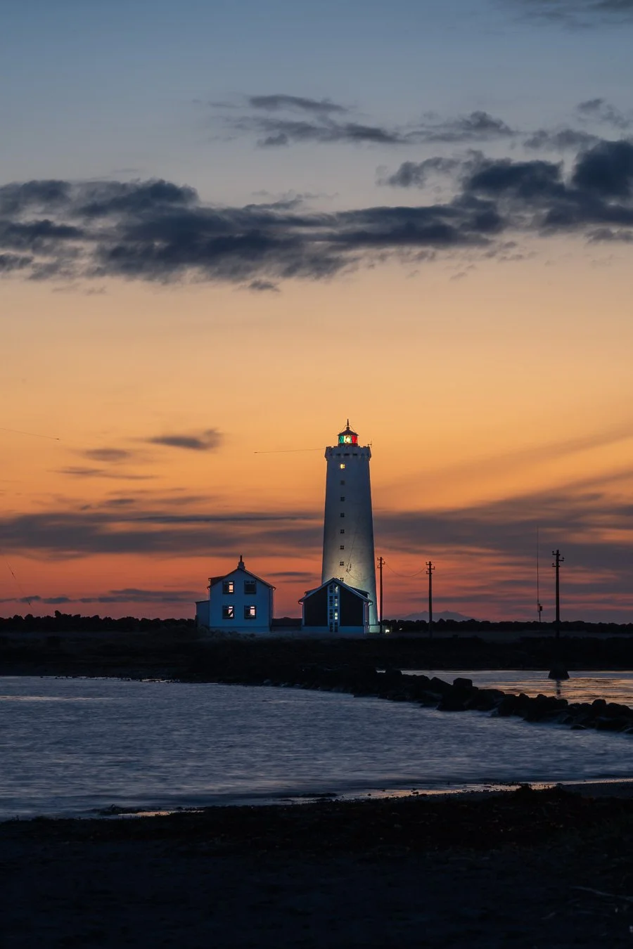
Grótta Island Lighthouse at sunset near Reykjavík.
Since skipping the hike saved us time, we visited Grótta Island Lighthouse for sunset. Located on the outskirts of Reykjavík, this small peninsula is known for its iconic lighthouse, stunning coastal views, and abundant wildlife. It’s also a popular northern light viewing spot.
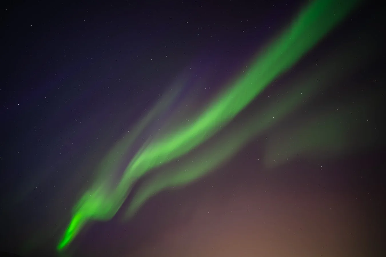
After watching the sunset at Grótta Island, we returned to the Reykjavík campground for dinner. However, with extremely high solar activity forecasted (a 90% chance of northern lights!), we decided to head back to the peninsula despite the cold and wind. By the time we arrived, dozens of cars had already filled not only the car park but also the road along the parking lots.
After waiting in the cold for quite some time, we finally spotted (our ‘first’) northern lights – at the very end of our Iceland trip! Despite being close to the city, the aurora display was incredibly intense. Watching the lights dance across the sky for the first time was truly awe-inspiring and unforgettable. Once the roads cleared, we returned to the campground to get some rest for our last full day in Iceland.
Grótta Island is one of the best places near Reykjavík to experience the magic of the northern lights.
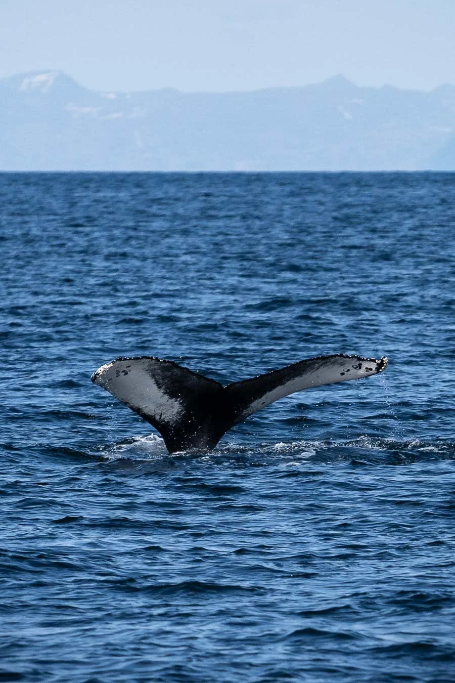
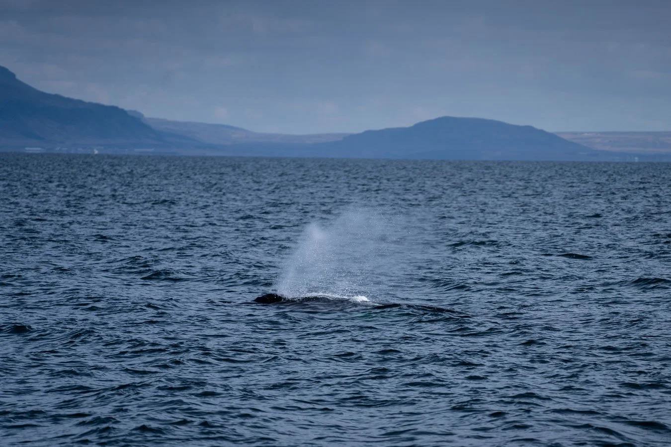
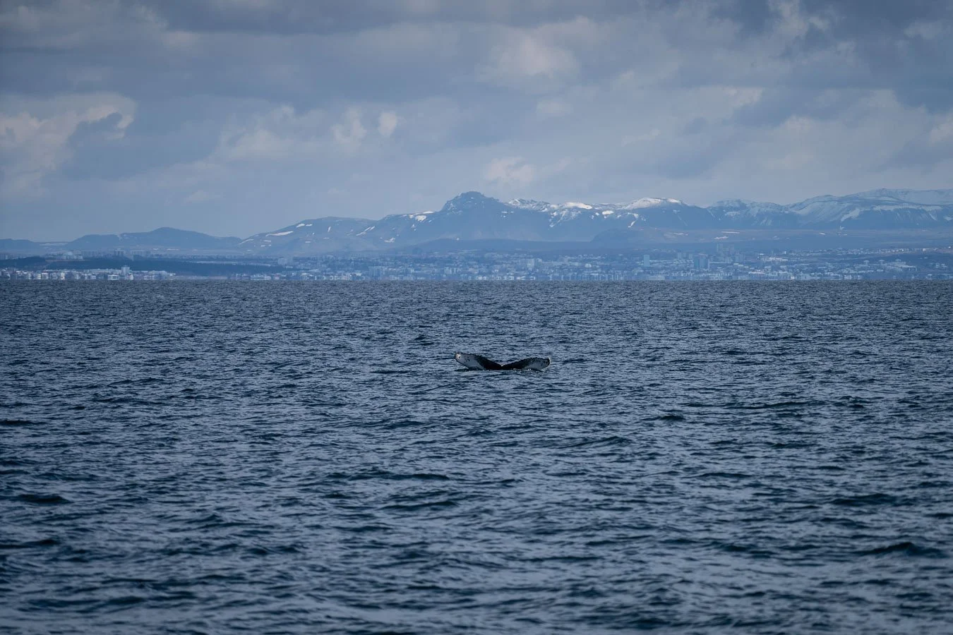
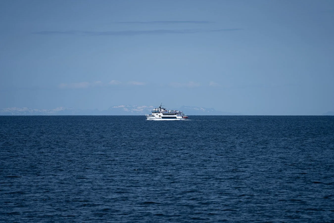
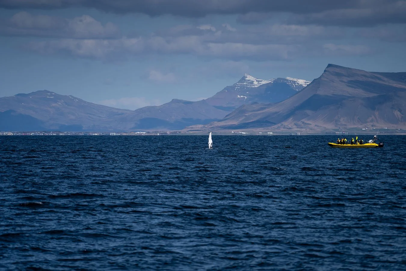
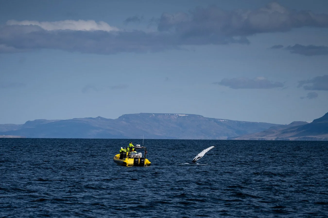
The next morning, we tried our luck again with a whale-watching tour in Reykjavík after our earlier cancellation in Húsavík. Several tour companies operate out of the harbor, offering trips on traditional boats (holding dozens of passengers) or smaller RHIB boats (for more intimate experiences). We opted for a larger boat since we weren’t sure about the camera policies for RHIB tours (if you plan to bring a DSLR with a telephoto lens, it’s worth checking with the operator beforehand). The larger boat was also slightly cheaper and featured sheltered indoor areas, which proved useful given the particularly cold and windy weather during the final days of our Iceland trip. Whenever one of the boats spotted whale activity, all the operators would head there, with the smaller RHIB boats arriving first. If you want a more personal and up-close experience, consider booking one of these tours instead. Despite the chilly conditions, we managed to spot several whales at short distances, including a playful whale that rolled over to show its belly! It was an amazing experience and a great way to spend our last day in Iceland.


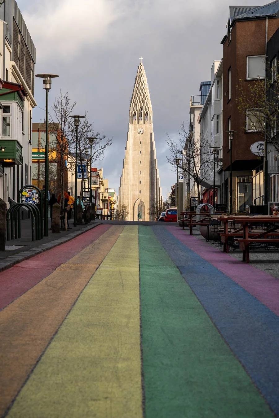
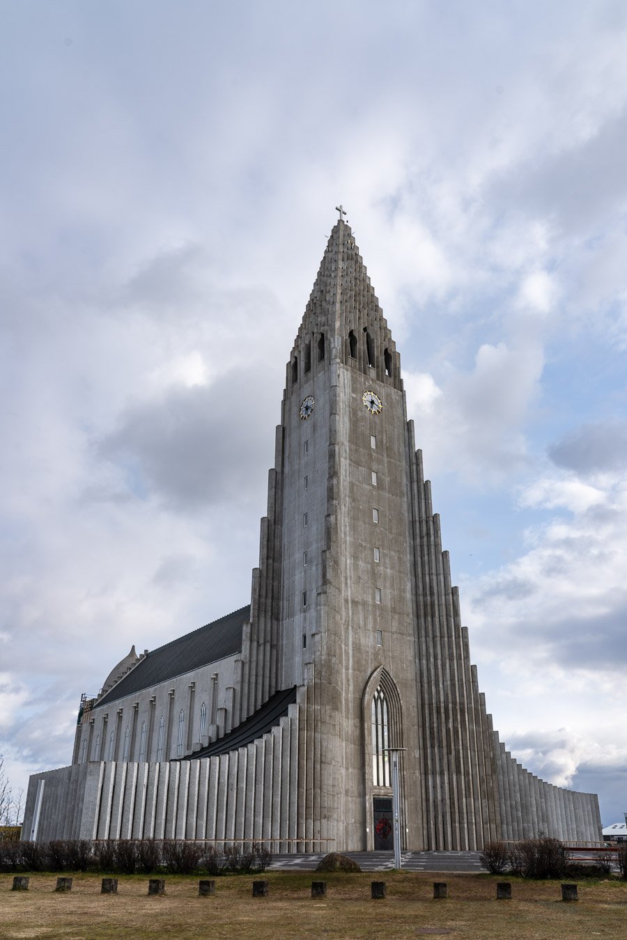
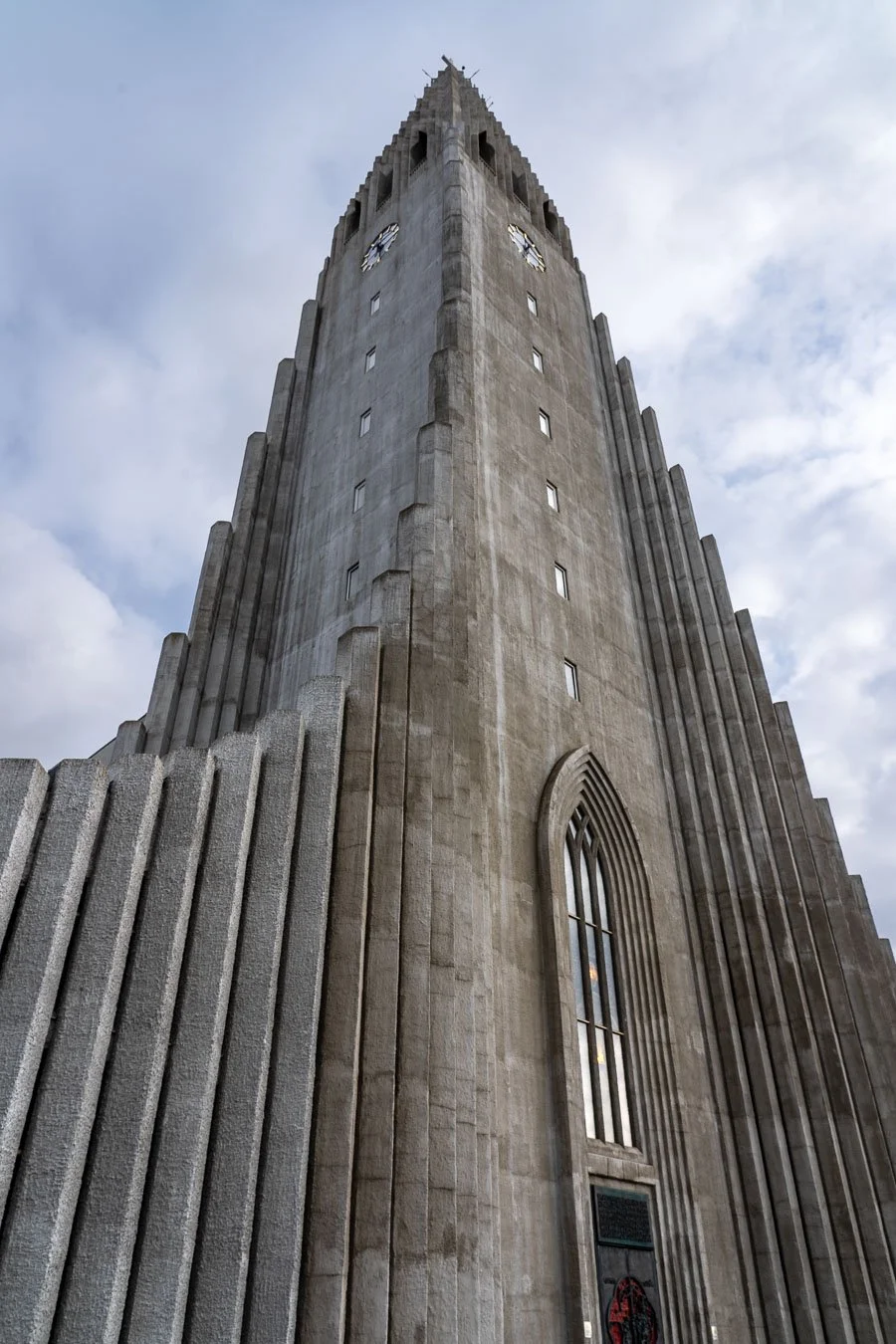

After warming up in a local café, we parked near the city center to explore Reykjavík on foot. The city is small compared to many other capitals, making its main attractions easily walkable. We began with the iconic Hallgrímskirkja Cathedral. Standing 74.5 m tall, it’s one of the tallest buildings in Iceland. Its unique architecture features a curved spire and side wings, reflecting Icelandic national identity. Nearby is Skólavörðustígur Rainbow Street, the city’s famous pedestrian area. This area is filled with boutiques, restaurants, cafés, and museums. It’s a charming and cozy place to wander around and soak in Reykjavík’s unique atmosphere. Here, you can also find many of Reykjavík’s infamous cats, usually snuggled up in one of the street’s many shops. The next morning, we returned our campervan near Reykjavík and caught a ride from the rental company to the airport, concluding our first Iceland adventure!
We hope some of our experiences and photos will inspire you to visit Iceland and explore its incredible landscapes for yourself!
Planning & Preparation Advice
We spent 12 full days in Iceland, which was enough time to comfortably circle the island and visit many incredible places. However, having a few extra days would have allowed for greater flexibility, especially for spots like Fjaðrárgljúfur Canyon or more remote sites such as Hengifoss Waterfall. If your schedule and budget allow, consider adding a few extra days so you can take your time exploring the Ring Road at a slower pace. This way, if you ever return, you can fully focus on Iceland’s remote Highlands without feeling like you missed out on the iconic coastal areas.
On the other hand, if you’re really short on time but still want a taste of Iceland, consider exploring the Golden Circle, located close to Reykjavík. This well-known route includes several impressive landmarks and historic sites, is accessible year-round, and can be explored in 1 to 3 days. While the Golden Circle offers a glimpse of Iceland’s unique landscapes, it only scratches the surface. Another alternative is to explore just certain sections of the Ring Road – for example, focusing on the south coast, where you’ll find some of Iceland’s most stunning sites. Highlights include waterfalls like Gljúfrabúi and Skógafoss, the black sand beaches near Vík, Jökulsárlón Glacier Lagoon, Diamond Beach, and even Vestrahorn, which became one of our personal favorites.
When planning your trip, it’s helpful to research driving distances, road types (especially if venturing off the paved Ring Road), and estimated durations for hikes or activities. Depending on the season, daylight hours may still be limited, so it’s wise to be realistic with your itinerary. Allow some buffer time in your schedule (as you may find yourself wanting to linger longer at certain breathtaking spots).
April worked well for us, as the weather was relatively mild, and many areas were less crowded. While we didn’t encounter any significant snow on the roads, the landscape still appeared quite barren, as spring hadn’t fully arrived yet. This actually enhanced the island’s stark, otherworldly beauty. Keep in mind that some trails and attractions may still be closed early in the spring season, and the Highlands remain inaccessible until summer. However, this made April the perfect time to focus solely on the Ring Road.
One consideration for off-season travel is the reduced number of open campsites. While April was quiet enough that we could show up at campsites without reservations, it’s worth booking ahead, especially as Iceland’s popularity continues to grow. Many campsites operate at reduced capacity during the shoulder season, making early planning a safe bet.
Lastly, we managed our entire trip without ever needing Icelandic cash, as credit and debit cards are accepted everywhere. Even remote gas stations are typically automated and work with international cards, making travel logistics surprisingly simple.
Recommendations & Lessons Learned
Unlike our Patagonia adventure, our trip around Iceland went surprisingly smoothly, with no major mishaps. However, looking back, we would have reconsidered visiting certain remote locations with our 2WD camper. For example, the roads leading to Svörtuloft Lighthouse and Hvítserkur were in notably poor condition, featuring large potholes and sharp rocks. If you’re set on visiting such places, renting a vehicle with higher ground clearance and 4WD is highly recommended. Alternatively, upgrading your rental insurance to cover undercarriage and tire damage can offer extra peace of mind, as basic policies usually exclude these types of damage.
That said, most gravel roads off the Ring Road were surprisingly well-maintained and manageable with a standard 2WD vehicle. For travelers on a budget, planning ahead and skipping rougher-access locations can help avoid unnecessary risks and costs. We found Google reviews particularly useful for assessing road conditions at specific destinations. Checking recent reviews before setting out can be invaluable, especially since Icelandic roads can change quickly due to weather and seasonal maintenance. For general road information you can always visit websites such as road.is (or umferdin.is).
Speaking of road conditions, Iceland’s Highlands are a special consideration. These remote, rugged regions in the island's interior are only accessible during the summer months, typically from June to August, depending on weather conditions. A 4WD vehicle is mandatory for driving on the unpaved mountain routes known as F-roads, which can be challenging even for experienced drivers. Since the Highlands were closed during our visit, we stuck to the coastal areas and the Ring Road, which provided plenty of stunning sights without requiring a specialized vehicle.
While road conditions are one thing, Iceland’s powerful winds present an entirely different challenge. Wind speeds can reach dangerous levels, particularly in coastal areas, on mountain passes, and across exposed plains. Campervans or vehicles with roof tents are especially vulnerable due to their higher center of gravity. It’s crucial to hold car doors securely when opening them, as strong gusts can violently fling them open, potentially causing damage or injury.
Staying informed about current weather conditions is essential when driving in Iceland. Websites like safetravel.is provide accurate, real-time updates on weather alerts, wind warnings, and potential road closures. Drivers should reduce their speed when traveling through exposed areas to maintain control of the vehicle and avoid sudden swerves caused by unexpected gusts.
When parking in windy conditions, positioning the vehicle parallel to the wind direction can help reduce the risk of tipping, especially for larger vehicles like campervans. Icelandic authorities take road safety seriously and frequently post warning signs in high-risk areas, so paying attention to these markers can prevent potentially dangerous situations.
Another essential safety tip concerns Iceland’s famous black sand beaches, such as Reynisfjara Beach. While these beaches are breathtaking, they’re also notoriously dangerous due to sneaker waves – unexpected, powerful waves that can sweep people into the ocean without warning. Posted safety signs are there for good reason, and we strongly advise staying well back from the water’s edge, especially during stormy weather.
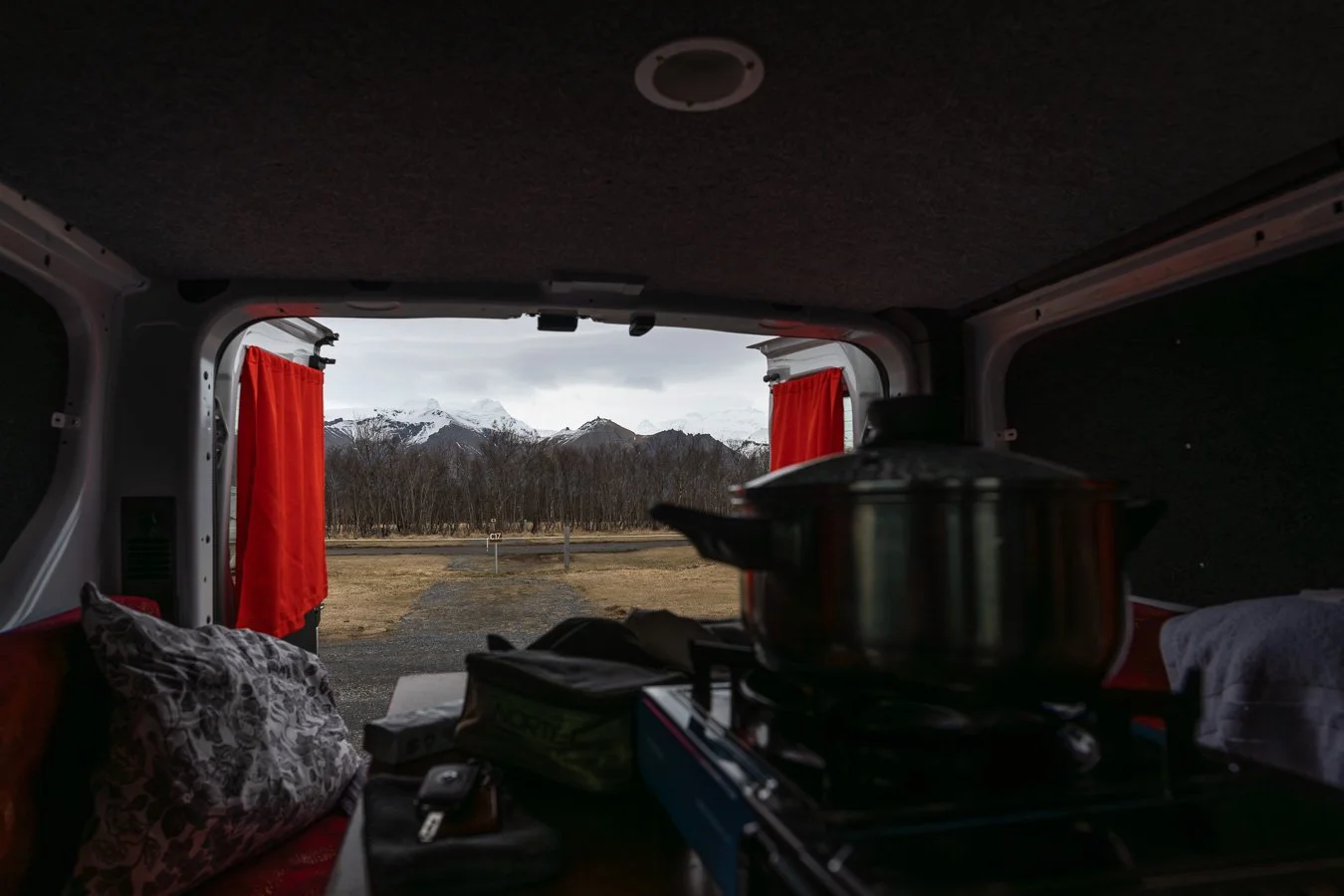
On a more practical note, eating out in Iceland can quickly become expensive, which is why cooking our own meals proved to be the most budget-friendly option throughout our trip. Our campervan came equipped with basic kitchen gear, which we used frequently, as many Icelandic campsites offer only minimal facilities – often just toilets, showers, and dishwashing sinks. This approach still allowed us the occasional treat, like a coffee or pastry from local cafés.
We booked our campervan through the rental company Go Campers Iceland, which also provided additional camping gear like chairs and a folding table. While we didn’t use the table much due to the chilly, rainy weather in April, the chairs were perfect for aurora watching on clear nights. If you’re traveling during the warmer summer months, extra outdoor gear like a camping table might be more useful for dining outside. Overall, we were very happy with our experience with Go Campers Iceland, but there are plenty of other rental companies to choose from. It’s always a good idea to compare a few operators to find the best option for your needs and budget.
Lastly, Iceland’s unpredictable weather was something we had expected but still found challenging at times. In April, temperatures generally are slowly climbing, and precipitation is slightly reduced compared to the winter months, but sudden weather changes can nonetheless be frequent. We came prepared with a variety of warm clothing layers, including insulating base layers, waterproof outer shells, hats, and gloves. Waterproof hiking boots also proved invaluable for outdoor activities, especially in the wetter southern regions, where rain seemed to follow us regularly.
Being well-prepared allowed us to enjoy Iceland’s breathtaking landscapes while staying safe and comfortable throughout our journey. With the right vehicle, gear, and mindset, exploring Iceland's Ring Road can be an unforgettable adventure filled with natural wonders and unique experiences.
Conclusion
In summary, we thoroughly enjoyed our road trip along Iceland’s iconic Ring Road. This route showcases some of the country’s most famous natural wonders, including stunning waterfalls, awe-inspiring glaciers and glacier lagoons, dramatic mountains and rock formations, as well as fascinating geothermal and volcanic sites that create otherworldly black sand beaches. Many of these sights are located directly along the Ring Road or are easily accessible with short detours, making the journey both convenient and rewarding.
Iceland also offers unique wildlife experiences, such as riding Icelandic horses, whale-watching tours, or spotting adorable puffins during the right season. Beyond adventurous outdoor activities, the island's many hot springs provide the perfect opportunity to slow down, relax, and recharge after a day of exploration.
For those interested in Icelandic culture, the capital Reykjavík and the northern town of Akureyri (often referred to as the ‘Capital of the North’) offer cultural experiences, charming local shops, and great dining options. These towns provide a pleasant contrast to the rugged, remote landscapes encountered throughout the journey.
With its combination of safety, accessibility, and incredible scenery, the Ring Road is not only ideal for discovering Iceland’s diverse landscapes but also an excellent option for first-time road-trippers or campers. Despite its remote feel, the Ring Road is well-developed, with full mobile coverage and plenty of tourists traveling the same route – offering a reassuring sense of safety in case of emergencies. This stands in stark contrast to more isolated destinations, like Patagonia, where assistance can be far less accessible.
If you’re short on time, it’s still possible to experience Iceland by focusing on specific sections of the Ring Road. The southern coast, for example, is often visited on shorter trips, offering iconic sights such as Seljalandsfoss, Skógafoss, Reynisfjara Beach, and Jökulsárlón Glacier Lagoon. Even a few days in this region can provide a fantastic introduction to Iceland’s breathtaking landscapes.
Driving the Ring Road in April worked perfectly for us. It was a good compromise between catching the last chance for northern lights and enjoying longer, warmer days for daytime exploration. We also found that fewer tourists were around, making the experience even more special.
We’re already planning to return to Iceland to explore the Highlands more extensively. We hope to hike multi-day trails like the Laugavegur trail and finally spot some puffins, which we narrowly missed during our last visit.
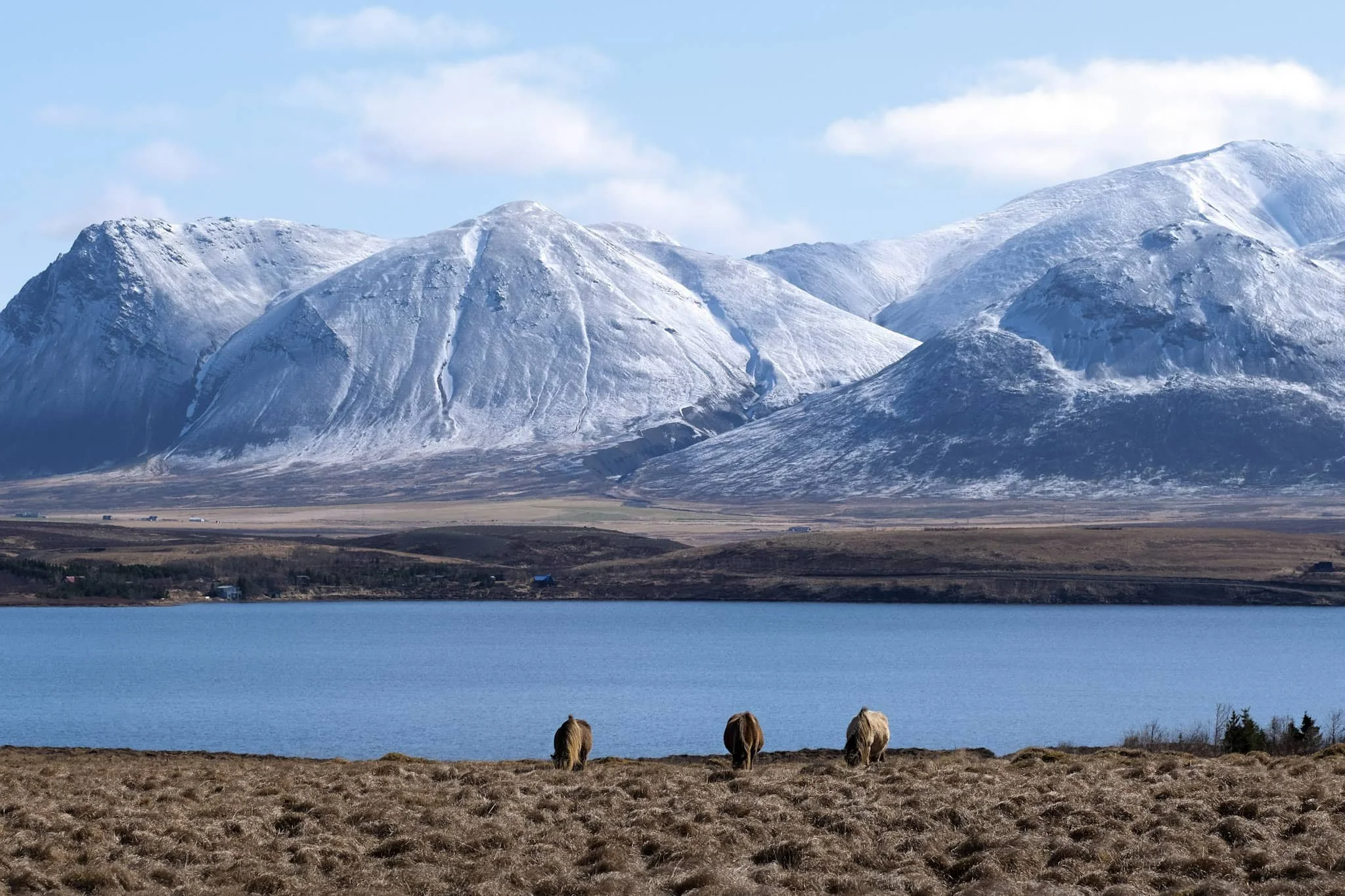
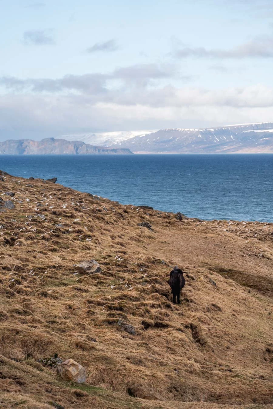
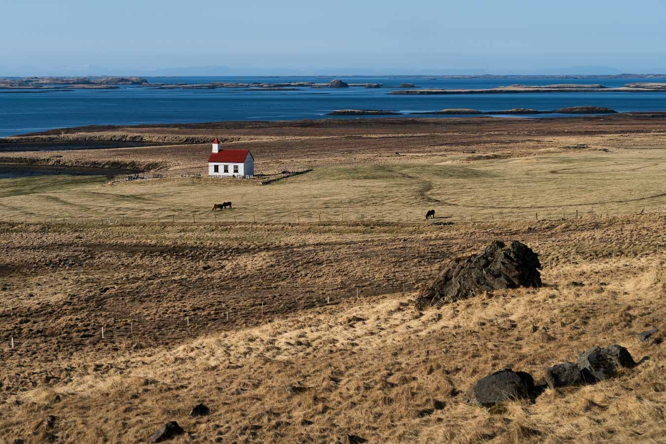
Horses grazing by the sea with snow-capped mountains in the distance – a scene capturing Iceland's timeless and charming essence.
Useful Links
Here’s a selection of links that may assist you with planning and staying safe during your own Iceland Ring Road trip!
General Links
General safety information (also available as an app)
Wind speeds (also available as an app)
Volcano Information
Information about the former eruption sites of Fagradalsfjall (details about the latest eruption sites are added as soon as they are open to visitors)
Other Links
Map
For the best viewing experience, exploring this website on a desktop browser is recommended.
Due to the large number of featured photos, the images are somewhat compressed. For higher-quality versions of selected pictures, visit the photo gallery!
If you enjoyed this blog post and want to see more content beyond Iceland’s Ring Road, explore the blog posts from other journeys around the world!
And in case you have more questions about the itinerary or anything else, feel free to get in touch here!